Area Overview for DE24 9AW
Photos of DE24 9AW
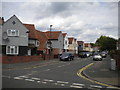
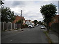
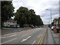
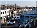
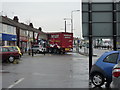
35 photos from this area
Area Information
Key information about the DE24 9AW including its size, population, and administrative classification.
- Area Type
- Postcode
- Area Size
- 3.4 hectares
- Population
- 1854
- Population Density
- 2445 people/km²
House Prices in DE24 9AW
41
Properties
£99,792
Average Sold Price
£56,000
Lowest Price
£175,000
Highest Price
Showing 41 properties
| Address | Type | Beds | Baths | Last Sale Price | Last Sale Date | |
|---|---|---|---|---|---|---|
| 88 Lord Street, Derby, DE24 9AW | house | - | - | £165,000 | Sep 2022 | |
| 40 Lord Street, Derby, DE24 9AW | house | 2 | 1 | £120,000 | Mar 2022 | |
| 12 Lord Street, Derby, DE24 9AW | house | - | - | £175,000 | Feb 2022 | |
| 66 Lord Street, Derby, DE24 9AW | house | - | - | £110,000 | Mar 2021 | |
| 68 Lord Street, Derby, DE24 9AW | house | 2 | 1 | £121,000 | Jul 2020 | |
| 60 Lord Street, Derby, DE24 9AW | Terraced | 2 | 1 | £58,000 | May 2013 | |
| 84 Lord Street, Derby, DE24 9AW | house | - | - | £98,000 | Jul 2007 | |
| 48 Lord Street, Derby, DE24 9AW | house | - | - | £80,000 | May 2007 | |
| 18 Lord Street, Derby, DE24 9AW | Terraced | - | - | £77,000 | Apr 2005 | |
| 62 Lord Street, Derby, DE24 9AW | Terraced | - | - | £66,500 | Apr 2005 |
Page 1 of 5
Energy Efficiency in DE24 9AW
Amenities
Schools
| Rank | School | Type | Entry gender | Ages |
|---|
Explore more schools in this area
Go to Schools tabDemographics
Household Size
Family (3-5 people)
most common
Accommodation Type
Houses
most common
Tenure
38
majority
Ethnic Group
White
most common
Religion
N/A
most common
Household Composition
N/A
most common
Age
47
median
Adults (30-64 years)
most common
Household Deprivation
N/A
with no deprivation
NS-SEC
13
in Lower managerial occupations
Explore more demographic insights in this area
Go to Demographics tabPlanning
Planning Constraints
- Flood RiskPremium
- Ramsar Wetland SitesPremium
- Area of Outstanding Natural BeautyPremium
- Protected Nature ReservePremium
- Protected WoodlandPremium