Area Overview for DE24 8JL
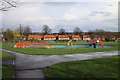
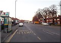
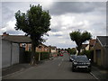
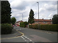
Photos of DE24 8JL


Area Information
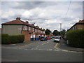
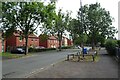
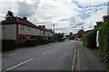
DE24 8JL is a small residential postcode area nestled in the Alvaston North ward of Derby, positioned approximately three miles south-east of Derby city centre. This compact neighbourhood falls within the broader Alvaston suburb, a district defined by its proximity to the A6 motorway and its role as a transitional zone between Derby’s urban core and the surrounding South Derbyshire countryside. With a population of 2,364, the area is characterised by a mix of older and newer housing stock, predominantly single-family homes. Its location offers a balance of urban accessibility and suburban tranquillity, with easy access to Derby’s amenities via the A6 and nearby railway stations. The area’s small size means it is tightly integrated with surrounding suburbs, creating a cohesive local identity. While it lacks the density of central Derby, its proximity to the city’s transport networks and retail hubs ensures residents are well-connected. However, the area’s safety profile—marked by a high crime risk—requires careful consideration for prospective buyers.
- Area Type
- Postcode
- Area Size
- Not available
- Population
- 2364
- Population Density
- 2945 people/km²
The property market in DE24 8JL is defined by its low home ownership rate of 32% and the prevalence of houses as the primary accommodation type. This suggests a rental market that dominates over owner-occupation, with many properties likely leased to tenants rather than sold to buyers. The area’s small size means the housing stock is limited, and buyers seeking properties here may need to consider the broader Alvaston suburb or surrounding areas for more options. The predominance of houses, as opposed to flats or apartments, indicates a focus on traditional family homes, though the low ownership rate implies limited opportunities for long-term investment. Prospective buyers should be mindful of the area’s size and its integration with nearby suburbs, which may offer additional property choices.
House Prices in DE24 8JL
No properties found in this postcode.
Energy Efficiency in DE24 8JL
Daily life in DE24 8JL is shaped by its proximity to essential retail and transport hubs. Within practical reach are shops such as Farmfoods Allenton, Co-op Osmaston, and Heron Ormaston, offering grocery and general retail services. The area’s railway stations—Peartree, Derby, and Spondon—provide access to Derby’s city centre and regional connections, making commuting and travel convenient. While the data does not specify dining or leisure facilities, the presence of multiple retail outlets suggests a functional local economy. The small size of the area means amenities are closely clustered, reducing the need for long commutes. However, the lack of detailed information on parks or recreational spaces means residents may rely on nearby suburbs for such facilities. The combination of retail accessibility and transport links creates a practical, if modest, lifestyle for residents.
Amenities
Schools
| Rank | School | Type | Entry gender | Ages |
|---|
Explore more schools in this area
Go to Schools tabDemographics
The community in DE24 8JL has a median age of 47, with the majority of residents falling within the 30–64 age range. This suggests a population skewed toward established adults, likely including professionals, families, and retirees. Home ownership rates are relatively low at 32%, indicating a significant proportion of residents rent their homes. The accommodation type is predominantly houses, rather than flats or apartments, which may reflect the area’s suburban character. The predominant ethnic group is White, with no specific data provided on other demographics. The age profile and housing stock suggest a stable, long-term resident base, though the lower home ownership rate could indicate a transient element. The absence of detailed diversity statistics means the community’s composition beyond the White majority remains unspecified.
Household Size
Accommodation Type
Tenure
Ethnic Group
Religion
Household Composition
Age
Household Deprivation
NS-SEC
Explore more demographic insights in this area
Go to Demographics tabPlanning
Planning Constraints
- Flood RiskPremium
- Ramsar Wetland SitesPremium
- Area of Outstanding Natural BeautyPremium
- Protected Nature ReservePremium
- Protected WoodlandPremium