Area Overview for DE24 8JF
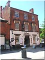
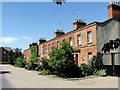
Photos of DE24 8JF


Area Information
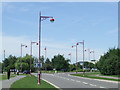
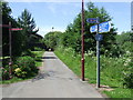
DE24 8JF is a small residential postcode cluster in Derby, part of the Alvaston North electoral ward. With a population of 1591 and a density of 807 people per square kilometre, it is a compact area situated approximately three miles south-east of Derby city centre. The postcode lies along the A6, a major route connecting Derby to surrounding regions, placing it at the edge of the city but within reach of urban amenities. The area is characterised by a mix of housing types, though the predominant form is houses, reflecting a suburban feel. Daily life here is shaped by proximity to Derby’s infrastructure, including railway stations and retail hubs. The community is primarily composed of adults aged 30–64, suggesting a stable demographic with established households. While the area lacks natural constraints like protected woodlands or wetlands, its location offers practical access to Derby’s broader services, making it a viable option for those seeking a balance between urban convenience and residential tranquillity.
- Area Type
- Postcode
- Area Size
- Not available
- Population
- 1591
- Population Density
- 807 people/km²
The property market in DE24 8JF is dominated by houses, with 32% of residents owning their homes. This relatively low home ownership rate suggests that the area is more rental-focused than owner-occupied, which could influence the types of properties available. The prevalence of houses over flats or apartments indicates a suburban character, potentially appealing to families or those seeking more space. However, the small size of the postcode and its location at the edge of Derby mean that buyers may need to look beyond the immediate area for a broader range of options. The market is likely influenced by Derby’s broader economic dynamics, with properties here possibly priced competitively compared to central Derby. For buyers, this could present opportunities but also challenges, such as limited inventory and the need to consider surrounding areas for larger selections.
House Prices in DE24 8JF
No properties found in this postcode.
Energy Efficiency in DE24 8JF
The lifestyle in DE24 8JF is shaped by its proximity to retail and transport hubs. Within reach are five major retail outlets, including Asda Pride, Tesco Derby, and M&S Derby, offering everyday shopping convenience. The area’s rail network, with five stations, ensures easy access to Derby’s cultural and commercial centres. While the data does not mention parks or leisure facilities, the presence of multiple retail and transport options suggests a practical, service-oriented lifestyle. Residents can enjoy the benefits of urban amenities without the congestion of central Derby, though outdoor recreational spaces may require travel to nearby areas. The mix of retail and transport infrastructure supports a balanced daily life, with shopping and commuting efficiently managed through existing networks.
Amenities
Schools
Residents of DE24 8JF have access to a range of educational institutions, including Zaytouna Primary School, which holds an Ofsted rating of 'good'. For further education, Derby Tertiary College, Wilmorton, and Derby College provide sixth-form courses, while Ascot College specialises in special needs education. Derby Pride Academy offers alternative educational pathways. The mix of school types ensures that families can find options from primary through to further education, though the absence of secondary schools within the postcode itself may require commuting. The presence of a 'good' rated primary school is a notable asset, particularly for parents prioritising early education quality. However, the reliance on nearby institutions highlights the importance of transport links for students needing to travel beyond the immediate area.
| Rank | School | Type | Entry gender | Ages |
|---|
Explore more schools in this area
Go to Schools tabDemographics
The population of DE24 8JF has a median age of 47, with the most common age range being adults aged 30–64. This suggests a community of middle-aged residents, many of whom may be in their peak working years or raising families. Home ownership in the area is relatively low at 32%, indicating that a majority of residents rent their homes. The predominant accommodation type is houses, which contrasts with higher-density housing seen in other urban areas. The predominant ethnic group is White, reflecting the broader demographic patterns of Derby. While the data does not specify deprivation levels, the low home ownership rate could imply a rental market that may affect long-term stability for some residents. The age profile also suggests a community with established routines, potentially prioritising stability over high turnover.
Household Size
Accommodation Type
Tenure
Ethnic Group
Religion
Household Composition
Age
Household Deprivation
NS-SEC
Explore more demographic insights in this area
Go to Demographics tabPlanning
Planning Constraints
- Flood RiskPremium
- Ramsar Wetland SitesPremium
- Area of Outstanding Natural BeautyPremium
- Protected Nature ReservePremium
- Protected WoodlandPremium