Area Overview for DE24 8HH
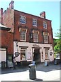
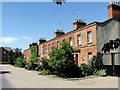
Photos of DE24 8HH


Area Information
DE24 8HH is a small residential postcode area within Derby, England, nestled in the Alvaston North electoral ward. Covering 7,193 square metres, it is a compact cluster of homes with a population of 1,591 residents, translating to a high density of 807 people per square kilometre. Situated approximately three miles south-east of Derby city centre along the A6, the area blends suburban comfort with proximity to urban amenities. Its location offers easy access to Derby’s cultural and economic hubs while maintaining a quieter, residential character. The postcode is part of the broader Alvaston district, a historically established suburb known for its mix of housing and community networks. Daily life here is shaped by local schools, nearby rail links, and the convenience of retail hubs. While the area is small, it is well-connected to Derby’s infrastructure, making it a practical choice for those seeking a balance between city accessibility and residential tranquillity. The presence of multiple schools and transport options suggests a focus on family-friendly living, though the high population density may influence the pace of life.
- Area Type
- Postcode
- Area Size
- 7193 m²
- Population
- 1591
- Population Density
- 807 people/km²
The property market in DE24 8HH is dominated by owner-occupied homes, though the 32% home ownership rate suggests that a majority of properties are rented. The accommodation type is predominantly houses, which are typically larger and suited to families or individuals seeking more space than flats. This mix may appeal to buyers looking for traditional housing stock, though the small area size means the market is limited in scope. The low home ownership percentage could indicate a rental-heavy market, potentially driven by students or professionals working in Derby’s city centre. For buyers, this suggests competition for available properties and the need to consider nearby areas for more options. The presence of houses rather than flats may also influence property prices, with larger homes potentially commanding higher values. However, the small size of the postcode means the market is not expansive, requiring buyers to look beyond DE24 8HH for broader choices.
House Prices in DE24 8HH
No properties found in this postcode.
Energy Efficiency in DE24 8HH
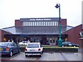
Living in DE24 8HH offers a blend of convenience and accessibility, with nearby amenities that cater to daily needs. Retail options include major stores like Costco Derby, Asda Pride, and M&S Wyvern, ensuring residents have access to groceries, clothing, and household essentials without long journeys. The area’s rail network, with stations such as Derby, Peartree, and Spondon, provides efficient commuting to Derby’s city centre and beyond. While parks and leisure facilities are not explicitly listed, the proximity to Derby suggests access to larger green spaces and recreational opportunities. The presence of multiple schools and transport links indicates a focus on family-friendly living, though the high population density may influence the character of public spaces. Overall, the area supports a practical lifestyle with essential services nearby, though residents may need to venture further for more specialised amenities.
Amenities
Schools
Residents of DE24 8HH have access to a range of educational institutions, from primary to sixth-form colleges. Zaytouna Primary School, rated ‘good’ by Ofsted, provides a solid foundation for younger children. For secondary and further education, options include Derby Tertiary College, Wilmorton, Derby College, and Ascot College, which specialises in special needs education. Derby Pride Academy offers additional educational pathways. This mix of school types ensures families can access schooling at multiple stages without relocating. The presence of both mainstream and specialist institutions suggests a commitment to catering to diverse educational needs, including those of students with additional requirements. However, the absence of a comprehensive secondary school within the immediate area may require parents to consider commuting to nearby institutions. The availability of sixth-form colleges also supports students pursuing post-16 education or vocational training.
| Rank | School | Type | Entry gender | Ages |
|---|
Explore more schools in this area
Go to Schools tabDemographics
The population of DE24 8HH is predominantly middle-aged, with a median age of 47 and the majority of residents falling within the 30–64 age range. This suggests a community of established professionals, families, and individuals in their later careers. Home ownership is relatively low at 32%, indicating that a significant portion of the housing stock is rented out, possibly reflecting a mix of long-term residents and transient populations. The area is characterised by houses rather than flats, aligning with a more traditional suburban layout. The predominant ethnic group is White, though specific data on diversity is not provided. The age profile and home ownership figures imply a community that may prioritise rental flexibility over long-term property investment. The high population density, combined with the prevalence of family-sized homes, suggests a balance between compact living and space for households. However, the low home ownership rate may also indicate limited opportunities for property value growth or equity accumulation for residents.
Household Size
Accommodation Type
Tenure
Ethnic Group
Religion
Household Composition
Age
Household Deprivation
NS-SEC
Explore more demographic insights in this area
Go to Demographics tabPlanning
Planning Constraints
- Flood RiskPremium
- Ramsar Wetland SitesPremium
- Area of Outstanding Natural BeautyPremium
- Protected Nature ReservePremium
- Protected WoodlandPremium