Area Overview for DE24 8FX
Photos of DE24 8FX
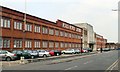
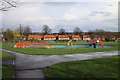
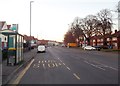
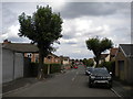
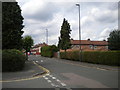
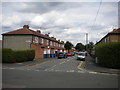
43 photos from this area
Area Information
Key information about the DE24 8FX including its size, population, and administrative classification.
- Area Type
- Postcode
- Area Size
- 4959 m²
- Population
- 2203
- Population Density
- 8666 people/km²
House Prices in DE24 8FX
14
Properties
£91,750
Average Sold Price
£58,500
Lowest Price
£148,000
Highest Price
Showing 14 properties
| Address | Type | Beds | Baths | Last Sale Price | Last Sale Date | |
|---|---|---|---|---|---|---|
| 45 Mortimer Street, Derby, DE24 8FX | house | - | - | £148,000 | Mar 2023 | |
| 53 Mortimer Street, Derby, DE24 8FX | Semi-detached | 3 | 1 | £93,000 | Feb 2020 | |
| 50 Mortimer Street, Derby, DE24 8FX | Semi-detached | 3 | - | £77,000 | Oct 2015 | |
| 52 Mortimer Street, Derby, DE24 8FX | house | 3 | - | £82,000 | Sep 2015 | |
| 62 Mortimer Street, Derby, DE24 8FX | Semi-detached | 3 | - | £92,000 | Oct 2013 | |
| 60 Mortimer Street, Derby, DE24 8FX | Semi-detached | - | - | £58,500 | Nov 2010 | |
| 49 Mortimer Street, Derby, DE24 8FX | Semi-detached | - | - | - | - | |
| 54 Mortimer Street, Derby, DE24 8FX | Semi-detached | - | - | - | - | |
| 55 Mortimer Street, Derby, DE24 8FX | house | - | - | - | - | |
| 58 Mortimer Street, Derby, DE24 8FX | Semi-detached | - | - | - | - |
Page 1 of 2
Energy Efficiency in DE24 8FX
Amenities
Schools
| Rank | School | Type | Entry gender | Ages |
|---|
Explore more schools in this area
Go to Schools tabDemographics
Household Size
Family (3-5 people)
most common
Accommodation Type
Houses
most common
Tenure
28
majority
Ethnic Group
White
most common
Religion
N/A
most common
Household Composition
N/A
most common
Age
22
median
Adults (30-64 years)
most common
Household Deprivation
N/A
with no deprivation
NS-SEC
14
in Lower managerial occupations
Explore more demographic insights in this area
Go to Demographics tabPlanning
Planning Constraints
- Flood RiskPremium
- Ramsar Wetland SitesPremium
- Area of Outstanding Natural BeautyPremium
- Protected Nature ReservePremium
- Protected WoodlandPremium