Area Overview for DE24 8DW
Photos of DE24 8DW

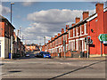
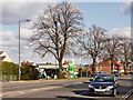
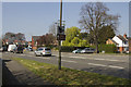
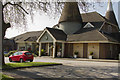
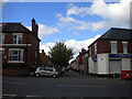
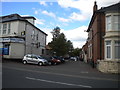
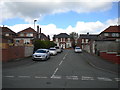
52 photos from this area
Area Information
Key information about the DE24 8DW including its size, population, and administrative classification.
- Area Type
- Postcode
- Area Size
- 2.2 hectares
- Population
- 2317
- Population Density
- 5057 people/km²
House Prices in DE24 8DW
91
Properties
£151,006
Average Sold Price
£27,000
Lowest Price
£245,000
Highest Price
Showing 91 properties
| Address | Type | Beds | Baths | Last Sale Price | Last Sale Date | |
|---|---|---|---|---|---|---|
| 62 Glossop Street, Derby, DE24 8DW | Semi-detached | 3 | 2 | £230,000 | Jan 2025 | |
| 95 Glossop Street, Derby, DE24 8DW | house | 3 | 1 | £198,000 | Oct 2024 | |
| 85 Glossop Street, Derby, DE24 8DW | house | - | - | £245,000 | Apr 2024 | |
| 103 Glossop Street, Derby, DE24 8DW | Semi-detached | 3 | 3 | £230,000 | Dec 2023 | |
| 46 Glossop Street, Derby, DE24 8DW | Semi-detached | 3 | 1 | £172,000 | Aug 2023 | |
| 88 Glossop Street, Derby, DE24 8DW | Semi-detached | 1 | 2 | £200,000 | Nov 2022 | |
| 74 Glossop Street, Derby, DE24 8DW | house | - | - | £215,000 | Feb 2022 | |
| 66 Glossop Street, Derby, DE24 8DW | house | - | - | £197,000 | Sep 2021 | |
| 71 Glossop Street, Derby, DE24 8DW | house | - | - | £175,000 | Sep 2021 | |
| 98 Glossop Street, Derby, DE24 8DW | house | - | - | £170,000 | Sep 2021 |
Page 1 of 10
Energy Efficiency in DE24 8DW
Amenities
Schools
| Rank | School | Type | Entry gender | Ages |
|---|
Explore more schools in this area
Go to Schools tabDemographics
Household Size
Family (3-5 people)
most common
Accommodation Type
Houses
most common
Tenure
35
majority
Ethnic Group
White
most common
Religion
N/A
most common
Household Composition
N/A
most common
Age
47
median
Adults (30-64 years)
most common
Household Deprivation
N/A
with no deprivation
NS-SEC
13
in Lower managerial occupations
Explore more demographic insights in this area
Go to Demographics tabPlanning
Planning Constraints
- Flood RiskPremium
- Ramsar Wetland SitesPremium
- Area of Outstanding Natural BeautyPremium
- Protected Nature ReservePremium
- Protected WoodlandPremium