Area Overview for DE24 8DG
Photos of DE24 8DG
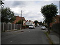
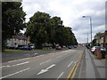
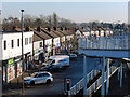
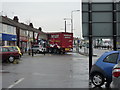
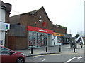
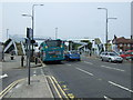
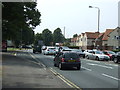
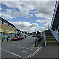
35 photos from this area
Area Information
Key information about the DE24 8DG including its size, population, and administrative classification.
- Area Type
- Postcode
- Area Size
- 6787 m²
- Population
- 1854
- Population Density
- 2445 people/km²
House Prices in DE24 8DG
24
Properties
£96,324
Average Sold Price
£30,690
Lowest Price
£171,000
Highest Price
Showing 24 properties
| Address | Type | Beds | Baths | Last Sale Price | Last Sale Date | |
|---|---|---|---|---|---|---|
| 19 Peveril Street, Derby, DE24 8DG | house | - | - | £155,000 | Jun 2025 | |
| 17 Peveril Street, Derby, DE24 8DG | Semi-detached | 3 | - | £171,000 | Jul 2023 | |
| 15 Peveril Street, Derby, DE24 8DG | house | - | - | £142,000 | May 2023 | |
| 14 Peveril Street, Derby, DE24 8DG | Semi-detached | 3 | - | £122,500 | Apr 2016 | |
| 16 Peveril Street, Derby, DE24 8DG | Semi-detached | 3 | - | £78,000 | Nov 2013 | |
| 5 Peveril Street, Derby, DE24 8DG | house | 3 | - | £63,100 | Apr 2012 | |
| 2 Peveril Street, Derby, DE24 8DG | house | - | - | £63,000 | Jan 2009 | |
| 7 Peveril Street, Derby, DE24 8DG | Semi-detached | - | - | £86,950 | Jan 2006 | |
| 6 Peveril Street, Derby, DE24 8DG | Semi-detached | - | - | £30,690 | Mar 2004 | |
| 18 Peveril Street, Derby, DE24 8DG | house | - | - | £51,000 | Dec 2002 |
Page 1 of 3
Energy Efficiency in DE24 8DG
Amenities
Schools
| Rank | School | Type | Entry gender | Ages |
|---|
Explore more schools in this area
Go to Schools tabDemographics
Household Size
Family (3-5 people)
most common
Accommodation Type
Houses
most common
Tenure
38
majority
Ethnic Group
White
most common
Religion
N/A
most common
Household Composition
N/A
most common
Age
47
median
Adults (30-64 years)
most common
Household Deprivation
N/A
with no deprivation
NS-SEC
13
in Lower managerial occupations
Explore more demographic insights in this area
Go to Demographics tabPlanning
Planning Constraints
- Flood RiskPremium
- Ramsar Wetland SitesPremium
- Area of Outstanding Natural BeautyPremium
- Protected Nature ReservePremium
- Protected WoodlandPremium