Area Overview for DE24 3LN
Photos of DE24 3LN
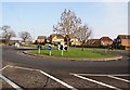

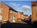
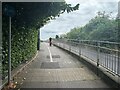
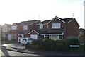


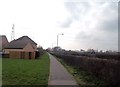
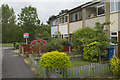
16 photos from this area
Area Information
Key information about the DE24 3LN including its size, population, and administrative classification.
- Area Type
- Postcode
- Area Size
- 7649 m²
- Population
- 1342
- Population Density
- 5716 people/km²
House Prices in DE24 3LN
16
Properties
£144,454
Average Sold Price
£68,950
Lowest Price
£285,000
Highest Price
Showing 16 properties
| Address | Type | Beds | Baths | Last Sale Price | Last Sale Date | |
|---|---|---|---|---|---|---|
| 10 Tavistock Close, Stenson Fields, Derby, DE24 3LN | Detached | 4 | 2 | £285,000 | Jan 2025 | |
| 12 Tavistock Close, Stenson Fields, Derby, DE24 3LN | Detached | 4 | - | £230,000 | Sep 2019 | |
| 18 Tavistock Close, Stenson Fields, Derby, DE24 3LN | house | - | - | £197,000 | May 2016 | |
| 5 Tavistock Close, Stenson Fields, Derby, DE24 3LN | Detached | 4 | - | £200,000 | Aug 2011 | |
| 3 Tavistock Close, Stenson Fields, Derby, DE24 3LN | Detached | - | - | £180,000 | May 2006 | |
| 6 Tavistock Close, Stenson Fields, Derby, DE24 3LN | Detached | - | - | £126,000 | Feb 2003 | |
| 16 Tavistock Close, Stenson Fields, Derby, DE24 3LN | house | - | - | £139,000 | Jun 2002 | |
| 7 Tavistock Close, Stenson Fields, Derby, DE24 3LN | Detached | - | - | £139,000 | Jun 2002 | |
| 20 Tavistock Close, Stenson Fields, Derby, DE24 3LN | house | - | - | £99,950 | Apr 2002 | |
| 9 Tavistock Close, Stenson Fields, Derby, DE24 3LN | Detached | - | - | £119,950 | Mar 2002 |
Page 1 of 2
Energy Efficiency in DE24 3LN
Amenities
Schools
| Rank | School | Type | Entry gender | Ages |
|---|
Explore more schools in this area
Go to Schools tabDemographics
Household Size
Family (3-5 people)
most common
Accommodation Type
Houses
most common
Tenure
83
majority
Ethnic Group
White
most common
Religion
N/A
most common
Household Composition
N/A
most common
Age
47
median
Adults (30-64 years)
most common
Household Deprivation
N/A
with no deprivation
NS-SEC
30
in Lower managerial occupations
Explore more demographic insights in this area
Go to Demographics tabPlanning
Planning Constraints
- Flood RiskPremium
- Ramsar Wetland SitesPremium
- Area of Outstanding Natural BeautyPremium
- Protected Nature ReservePremium
- Protected WoodlandPremium