Area Overview for DE24 3HF
Photos of DE24 3HF
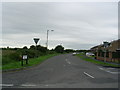

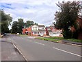
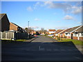
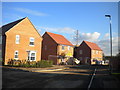
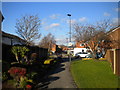
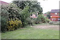
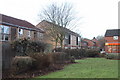
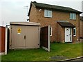

18 photos from this area
Area Information
Key information about the DE24 3HF including its size, population, and administrative classification.
- Area Type
- Postcode
- Area Size
- 1.2 hectares
- Population
- 1675
- Population Density
- 5532 people/km²
House Prices in DE24 3HF
22
Properties
£130,195
Average Sold Price
£54,000
Lowest Price
£210,000
Highest Price
Showing 22 properties
| Address | Type | Beds | Baths | Last Sale Price | Last Sale Date | |
|---|---|---|---|---|---|---|
| 282 Deep Dale Lane, Derby, DE24 3HF | Bungalow | 2 | 1 | £166,000 | Mar 2025 | |
| 246 Deep Dale Lane, Derby, DE24 3HF | Bungalow | 2 | 1 | £195,000 | Aug 2023 | |
| 278 Deep Dale Lane, Derby, DE24 3HF | Bungalow | 2 | 1 | £173,000 | Mar 2021 | |
| 252 Deep Dale Lane, Derby, DE24 3HF | Bungalow | 2 | 1 | £210,000 | Dec 2019 | |
| 280 Deep Dale Lane, Derby, DE24 3HF | Bungalow | 2 | 1 | £137,000 | Jun 2016 | |
| 272 Deep Dale Lane, Derby, DE24 3HF | Bungalow | 2 | - | £96,000 | Dec 2010 | |
| 262 Deep Dale Lane, Derby, DE24 3HF | Semi-detached | 3 | 1 | £92,000 | Oct 2003 | |
| 254 Deep Dale Lane, Derby, DE24 3HF | Bungalow | - | - | £129,995 | Sep 2003 | |
| 288 Deep Dale Lane, Derby, DE24 3HF | house | - | - | £99,950 | Nov 2002 | |
| 256 Deep Dale Lane, Derby, DE24 3HF | Detached | - | - | £79,200 | May 2000 |
Page 1 of 3
Energy Efficiency in DE24 3HF
Amenities
Schools
| Rank | School | Type | Entry gender | Ages |
|---|
Explore more schools in this area
Go to Schools tabDemographics
Household Size
Two person
most common
Accommodation Type
Houses
most common
Tenure
83
majority
Ethnic Group
White
most common
Religion
N/A
most common
Household Composition
N/A
most common
Age
47
median
Adults (30-64 years)
most common
Household Deprivation
N/A
with no deprivation
NS-SEC
29
in Lower managerial occupations
Explore more demographic insights in this area
Go to Demographics tabPlanning
Planning Constraints
- Flood RiskPremium
- Ramsar Wetland SitesPremium
- Area of Outstanding Natural BeautyPremium
- Protected Nature ReservePremium
- Protected WoodlandPremium