Area Overview for DE24 0QT
Photos of DE24 0QT
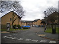
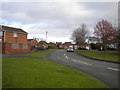
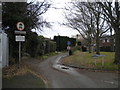
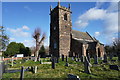
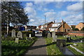
26 photos from this area
Area Information
Key information about the DE24 0QT including its size, population, and administrative classification.
- Area Type
- Postcode
- Area Size
- 1.9 hectares
- Population
- 1396
- Population Density
- 1919 people/km²
House Prices in DE24 0QT
46
Properties
£139,363
Average Sold Price
£43,000
Lowest Price
£265,000
Highest Price
Showing 46 properties
| Address | Type | Beds | Baths | Last Sale Price | Last Sale Date | |
|---|---|---|---|---|---|---|
| 35 Nesfield Close, Derby, DE24 0QT | house | - | - | £175,000 | Oct 2024 | |
| 33 Nesfield Close, Derby, DE24 0QT | Semi-detached | 3 | 2 | £220,000 | Jul 2024 | |
| 8 Nesfield Close, Derby, DE24 0QT | Detached | 3 | 1 | £265,000 | May 2024 | |
| 49 Nesfield Close, Derby, DE24 0QT | house | - | - | £150,000 | Oct 2023 | |
| 16 Nesfield Close, Derby, DE24 0QT | house | - | - | £258,000 | Oct 2022 | |
| 53 Nesfield Close, Derby, DE24 0QT | house | 2 | - | £130,000 | Mar 2021 | |
| 43 Nesfield Close, Derby, DE24 0QT | house | - | - | £80,000 | Feb 2021 | |
| 6 Nesfield Close, Derby, DE24 0QT | house | - | - | £215,000 | Nov 2020 | |
| 65 Nesfield Close, Derby, DE24 0QT | Terraced | 2 | 1 | £159,950 | Apr 2019 | |
| 3 Nesfield Close, Derby, DE24 0QT | Detached | 4 | 2 | £205,000 | Jan 2019 |
Page 1 of 5
Energy Efficiency in DE24 0QT
Amenities
Schools
| Rank | School | Type | Entry gender | Ages |
|---|
Explore more schools in this area
Go to Schools tabDemographics
Household Size
One person
most common
Accommodation Type
Houses
most common
Tenure
72
majority
Ethnic Group
White
most common
Religion
N/A
most common
Household Composition
N/A
most common
Age
47
median
Adults (30-64 years)
most common
Household Deprivation
N/A
with no deprivation
NS-SEC
32
in Lower managerial occupations
Explore more demographic insights in this area
Go to Demographics tabPlanning
Planning Constraints
- Flood RiskPremium
- Ramsar Wetland SitesPremium
- Area of Outstanding Natural BeautyPremium
- Protected Nature ReservePremium
- Protected WoodlandPremium