Area Overview for DE23 8UY
Photos of DE23 8UY

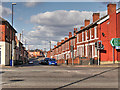
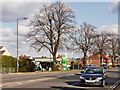
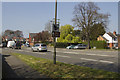
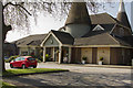
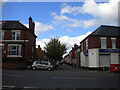
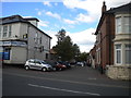
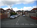
52 photos from this area
Area Information
Key information about the DE23 8UY including its size, population, and administrative classification.
- Area Type
- Postcode
- Area Size
- 8234 m²
- Population
- 2091
- Population Density
- 5020 people/km²
House Prices in DE23 8UY
44
Properties
£69,891
Average Sold Price
£10,000
Lowest Price
£130,000
Highest Price
Showing 44 properties
| Address | Type | Beds | Baths | Last Sale Price | Last Sale Date | |
|---|---|---|---|---|---|---|
| 28 Newdigate Street, Derby, DE23 8UY | Terraced | 2 | 1 | £120,000 | Dec 2024 | |
| 68 Newdigate Street, Derby, DE23 8UY | Terraced | 2 | 1 | £80,000 | May 2024 | |
| 50 Newdigate Street, Derby, DE23 8UY | Terraced | 2 | 1 | £115,000 | Dec 2022 | |
| 78 Newdigate Street, Derby, DE23 8UY | Terraced | 2 | 1 | £102,000 | Mar 2022 | |
| 48 Newdigate Street, Derby, DE23 8UY | Retail | 2 | 1 | £102,000 | Mar 2022 | |
| 70 Newdigate Street, Derby, DE23 8UY | house | 2 | 1 | £77,000 | Apr 2021 | |
| 64 Newdigate Street, Derby, DE23 8UY | Terraced | 2 | 1 | £75,000 | Mar 2021 | |
| 88 Newdigate Street, Derby, DE23 8UY | Terraced | 3 | - | £75,000 | Jan 2021 | |
| 84 Newdigate Street, Derby, DE23 8UY | Terraced | 2 | 1 | £90,000 | Aug 2020 | |
| 72 Newdigate Street, Derby, DE23 8UY | house | - | - | £47,500 | Nov 2016 |
Page 1 of 5
Energy Efficiency in DE23 8UY
Amenities
Schools
| Rank | School | Type | Entry gender | Ages |
|---|
Explore more schools in this area
Go to Schools tabDemographics
Household Size
Family (3-5 people)
most common
Accommodation Type
Houses
most common
Tenure
47
majority
Ethnic Group
White
most common
Religion
N/A
most common
Household Composition
N/A
most common
Age
47
median
Adults (30-64 years)
most common
Household Deprivation
N/A
with no deprivation
NS-SEC
15
in Lower managerial occupations
Explore more demographic insights in this area
Go to Demographics tabPlanning
Planning Constraints
- Flood RiskPremium
- Ramsar Wetland SitesPremium
- Area of Outstanding Natural BeautyPremium
- Protected Nature ReservePremium
- Protected WoodlandPremium