Area Overview for DE23 8RR
Photos of DE23 8RR

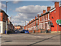
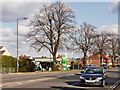
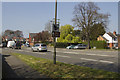
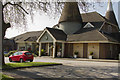
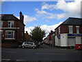
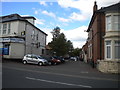
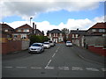
52 photos from this area
Area Information
Key information about the DE23 8RR including its size, population, and administrative classification.
- Area Type
- Postcode
- Area Size
- 1.5 hectares
- Population
- 1861
- Population Density
- 8256 people/km²
House Prices in DE23 8RR
45
Properties
£104,121
Average Sold Price
£39,000
Lowest Price
£260,000
Highest Price
Showing 45 properties
| Address | Type | Beds | Baths | Last Sale Price | Last Sale Date | |
|---|---|---|---|---|---|---|
| 135 Pear Tree Crescent, Derby, DE23 8RR | house | - | - | £260,000 | Nov 2024 | |
| 159 Pear Tree Crescent, Derby, DE23 8RR | house | - | - | £70,000 | Mar 2022 | |
| 130 Pear Tree Crescent, Derby, DE23 8RR | Semi-detached | 3 | 1 | £111,000 | Aug 2020 | |
| 120 Pear Tree Crescent, Derby, DE23 8RR | house | - | - | £110,000 | Nov 2019 | |
| 124 Pear Tree Crescent, Derby, DE23 8RR | Semi-detached | 3 | 1 | £128,000 | Aug 2019 | |
| 116 Pear Tree Crescent, Derby, DE23 8RR | house | - | - | £90,000 | Apr 2019 | |
| 183 Pear Tree Crescent, Derby, DE23 8RR | house | - | - | £128,000 | Mar 2019 | |
| 136 Pear Tree Crescent, Derby, DE23 8RR | house | - | - | £155,000 | Nov 2018 | |
| 181 Pear Tree Crescent, Derby, DE23 8RR | Semi-detached | 3 | 1 | £94,000 | Nov 2018 | |
| 147 Pear Tree Crescent, Derby, DE23 8RR | Semi-detached | 3 | 2 | £144,000 | Oct 2018 |
Page 1 of 5
Energy Efficiency in DE23 8RR
Amenities
Schools
| Rank | School | Type | Entry gender | Ages |
|---|
Explore more schools in this area
Go to Schools tabDemographics
Household Size
Family (3-5 people)
most common
Accommodation Type
Houses
most common
Tenure
58
majority
Ethnic Group
asian_total
most common
Religion
N/A
most common
Household Composition
N/A
most common
Age
47
median
Adults (30-64 years)
most common
Household Deprivation
N/A
with no deprivation
NS-SEC
13
in Lower managerial occupations
Explore more demographic insights in this area
Go to Demographics tabPlanning
Planning Constraints
- Flood RiskPremium
- Ramsar Wetland SitesPremium
- Area of Outstanding Natural BeautyPremium
- Protected Nature ReservePremium
- Protected WoodlandPremium