Area Overview for DE23 8LH
Photos of DE23 8LH
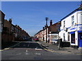
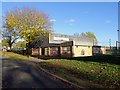
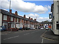
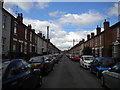
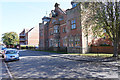
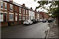
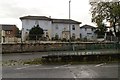
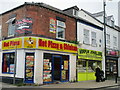
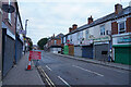
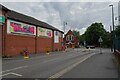
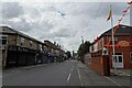
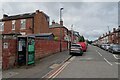
43 photos from this area
Area Information
Key information about the DE23 8LH including its size, population, and administrative classification.
- Area Type
- Postcode
- Area Size
- 8724 m²
- Population
- 1269
- Population Density
- 3640 people/km²
House Prices in DE23 8LH
29
Properties
£105,384
Average Sold Price
£10,000
Lowest Price
£590,000
Highest Price
Showing 29 properties
| Address | Type | Beds | Baths | Last Sale Price | Last Sale Date | |
|---|---|---|---|---|---|---|
| 5 Douglas Street, Derby, DE23 8LH | house | - | - | £197,000 | Apr 2025 | |
| 37 Douglas Street, Derby, DE23 8LH | house | 3 | 4 | £112,000 | Dec 2023 | |
| 6 Douglas Street, Derby, DE23 8LH | house | 4 | - | £78,000 | Nov 2023 | |
| 45 Douglas Street, Derby, DE23 8LH | Retail | 4 | 1 | £158,000 | Jul 2022 | |
| 38 Douglas Street, Derby, DE23 8LH | Terraced | - | - | £52,800 | Mar 2020 | |
| 44 Douglas Street, Derby, DE23 8LH | house | - | - | £90,000 | Oct 2019 | |
| 34 Douglas Street, Derby, DE23 8LH | house | - | - | £49,500 | Nov 2013 | |
| 2 Douglas Street, Derby, DE23 8LH | house | 2 | - | £90,000 | Feb 2010 | |
| 52 Douglas Street, Derby, DE23 8LH | house | - | - | £130,000 | Oct 2008 | |
| 35 Douglas Street, Derby, DE23 8LH | house | - | - | £60,000 | Feb 2008 |
Page 1 of 3
Energy Efficiency in DE23 8LH
Amenities
Schools
| Rank | School | Type | Entry gender | Ages |
|---|
Explore more schools in this area
Go to Schools tabDemographics
Household Size
One person
most common
Accommodation Type
Flats
most common
Tenure
19
majority
Ethnic Group
White
most common
Religion
N/A
most common
Household Composition
N/A
most common
Age
47
median
Adults (30-64 years)
most common
Household Deprivation
N/A
with no deprivation
NS-SEC
17
in Lower managerial occupations
Explore more demographic insights in this area
Go to Demographics tabPlanning
Planning Constraints
- Flood RiskPremium
- Ramsar Wetland SitesPremium
- Area of Outstanding Natural BeautyPremium
- Protected Nature ReservePremium
- Protected WoodlandPremium