Area Overview for DE23 8BQ
Photos of DE23 8BQ
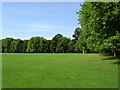
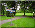
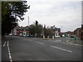
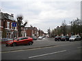
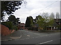
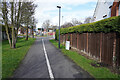
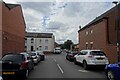
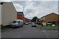
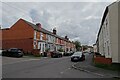
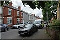
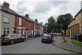
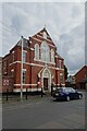
33 photos from this area
Area Information
Key information about the DE23 8BQ including its size, population, and administrative classification.
- Area Type
- Postcode
- Area Size
- 7014 m²
- Population
- 2639
- Population Density
- 9004 people/km²
House Prices in DE23 8BQ
28
Properties
£85,108
Average Sold Price
£25,500
Lowest Price
£150,000
Highest Price
Showing 28 properties
| Address | Type | Beds | Baths | Last Sale Price | Last Sale Date | |
|---|---|---|---|---|---|---|
| 168 Upper Dale Road, Derby, DE23 8BQ | Semi-detached | 4 | - | £130,000 | Mar 2023 | |
| 176 Upper Dale Road, Derby, DE23 8BQ | house | - | - | £150,000 | Feb 2023 | |
| 186 Upper Dale Road, Derby, DE23 8BQ | house | - | - | £66,308 | Aug 2022 | |
| 214 Upper Dale Road, Derby, DE23 8BQ | Terraced | 3 | 1 | £103,000 | Apr 2021 | |
| 208 Upper Dale Road, Derby, DE23 8BQ | house | 1 | 2 | £80,000 | Nov 2017 | |
| 178 Upper Dale Road, Derby, DE23 8BQ | Semi-detached | 3 | - | £85,000 | Dec 2015 | |
| 196 Upper Dale Road, Derby, DE23 8BQ | house | 4 | - | £115,000 | Jul 2015 | |
| 188 Upper Dale Road, Derby, DE23 8BQ | house | 1 | 1 | £110,000 | May 2013 | |
| 194 Upper Dale Road, Derby, DE23 8BQ | house | - | - | £125,000 | Mar 2012 | |
| 180 Upper Dale Road, Derby, DE23 8BQ | house | - | - | £80,000 | Oct 2010 |
Page 1 of 3
Energy Efficiency in DE23 8BQ
Amenities
Schools
| Rank | School | Type | Entry gender | Ages |
|---|
Explore more schools in this area
Go to Schools tabDemographics
Household Size
Family (3-5 people)
most common
Accommodation Type
Houses
most common
Tenure
40
majority
Ethnic Group
asian_total
most common
Religion
N/A
most common
Household Composition
N/A
most common
Age
22
median
Adults (30-64 years)
most common
Household Deprivation
N/A
with no deprivation
NS-SEC
11
in Lower managerial occupations
Explore more demographic insights in this area
Go to Demographics tabPlanning
Planning Constraints
- Flood RiskPremium
- Ramsar Wetland SitesPremium
- Area of Outstanding Natural BeautyPremium
- Protected Nature ReservePremium
- Protected WoodlandPremium