Area Overview for DE23 6TT
Photos of DE23 6TT
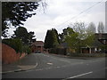
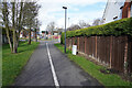
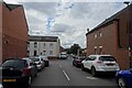
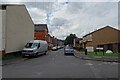
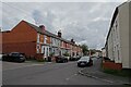
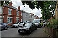
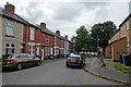
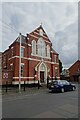
33 photos from this area
Area Information
Key information about the DE23 6TT including its size, population, and administrative classification.
- Area Type
- Postcode
- Area Size
- 7148 m²
- Population
- 2310
- Population Density
- 18033 people/km²
House Prices in DE23 6TT
48
Properties
£74,268
Average Sold Price
£14,500
Lowest Price
£142,000
Highest Price
Showing 48 properties
| Address | Type | Beds | Baths | Last Sale Price | Last Sale Date | |
|---|---|---|---|---|---|---|
| 54 Byron Street, Derby, DE23 6TT | house | - | - | £120,000 | May 2025 | |
| 30 Byron Street, Derby, DE23 6TT | house | - | - | £89,000 | Nov 2021 | |
| 84 Byron Street, Derby, DE23 6TT | house | - | - | £55,000 | Apr 2021 | |
| 22 Byron Street, Derby, DE23 6TT | house | - | - | £135,000 | Apr 2021 | |
| 8 Byron Street, Derby, DE23 6TT | Terraced | - | - | £98,000 | Sep 2016 | |
| 90A Byron Street, Derby, DE23 6TT | Flat | - | - | £142,000 | Oct 2015 | |
| 18 Byron Street, Derby, DE23 6TT | Semi-detached | 4 | 2 | £114,000 | Aug 2015 | |
| 42 Byron Street, Derby, DE23 6TT | Terraced | 3 | 1 | £60,500 | Oct 2014 | |
| 24 Byron Street, Derby, DE23 6TT | house | - | - | £57,000 | Jan 2014 | |
| 86 Byron Street, Derby, DE23 6TT | house | - | - | £65,000 | Oct 2011 |
Page 1 of 5
Energy Efficiency in DE23 6TT
Amenities
Schools
| Rank | School | Type | Entry gender | Ages |
|---|
Explore more schools in this area
Go to Schools tabDemographics
Household Size
Family (3-5 people)
most common
Accommodation Type
Houses
most common
Tenure
48
majority
Ethnic Group
asian_total
most common
Religion
N/A
most common
Household Composition
N/A
most common
Age
22
median
Adults (30-64 years)
most common
Household Deprivation
N/A
with no deprivation
NS-SEC
13
in Lower managerial occupations
Explore more demographic insights in this area
Go to Demographics tabPlanning
Planning Constraints
- Flood RiskPremium
- Ramsar Wetland SitesPremium
- Area of Outstanding Natural BeautyPremium
- Protected Nature ReservePremium
- Protected WoodlandPremium