Area Overview for DE23 6GE
Photos of DE23 6GE


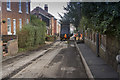
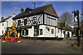
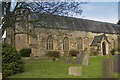
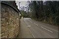

100 photos from this area
Area Information
Key information about the DE23 6GE including its size, population, and administrative classification.
- Area Type
- Postcode
- Area Size
- 4527 m²
- Population
- 1716
- Population Density
- 3183 people/km²
House Prices in DE23 6GE
14
Properties
£61,327
Average Sold Price
£34,250
Lowest Price
£79,000
Highest Price
Showing 14 properties
| Address | Type | Beds | Baths | Last Sale Price | Last Sale Date | |
|---|---|---|---|---|---|---|
| 14, Sidney Houses, Church Street, Littleover, Derby, DE23 6GE | Flat | 1 | - | £52,500 | Jul 2024 | |
| 4, Sidney Houses, Church Street, Littleover, Derby, DE23 6GE | Flat | - | - | £67,500 | Jul 2023 | |
| 2, Sidney Houses, Church Street, Littleover, Derby, DE23 6GE | Flat | - | - | £65,000 | Jul 2023 | |
| 9, Sidney Houses, Church Street, Littleover, Derby, DE23 6GE | Flat | 1 | 1 | £79,000 | Feb 2022 | |
| 6, Sidney Houses, Church Street, Littleover, Derby, DE23 6GE | Flat | - | - | £67,000 | Jul 2018 | |
| 1, Sidney Houses, Church Street, Littleover, Derby, DE23 6GE | Flat | - | - | £67,000 | Jan 2018 | |
| 11, Sidney Houses, Church Street, Littleover, Derby, DE23 6GE | Flat | - | - | £60,000 | Jun 2015 | |
| 3, Sidney Houses, Church Street, Littleover, Derby, DE23 6GE | Flat | 1 | - | £59,000 | Nov 2014 | |
| 10, Sidney Houses, Church Street, Littleover, Derby, DE23 6GE | Flat | - | - | £57,000 | Oct 2014 | |
| 12, Sidney Houses, Church Street, Littleover, Derby, DE23 6GE | Flat | - | - | £68,000 | Dec 2004 |
Page 1 of 2
Energy Efficiency in DE23 6GE
Amenities
Schools
| Rank | School | Type | Entry gender | Ages |
|---|
Explore more schools in this area
Go to Schools tabDemographics
Household Size
One person
most common
Accommodation Type
Houses
most common
Tenure
60
majority
Ethnic Group
White
most common
Religion
N/A
most common
Household Composition
N/A
most common
Age
47
median
Adults (30-64 years)
most common
Household Deprivation
N/A
with no deprivation
NS-SEC
42
in Lower managerial occupations
Explore more demographic insights in this area
Go to Demographics tabPlanning
Planning Constraints
- Flood RiskPremium
- Ramsar Wetland SitesPremium
- Area of Outstanding Natural BeautyPremium
- Protected Nature ReservePremium
- Protected WoodlandPremium