Area Overview for DE23 6FN
Photos of DE23 6FN
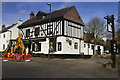
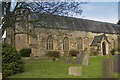
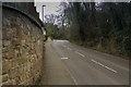
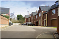
100 photos from this area
Area Information
Key information about the DE23 6FN including its size, population, and administrative classification.
- Area Type
- Postcode
- Area Size
- 9624 m²
- Population
- 2365
- Population Density
- 2188 people/km²
House Prices in DE23 6FN
10
Properties
£448,750
Average Sold Price
£165,000
Lowest Price
£575,000
Highest Price
Showing 10 properties
| Address | Type | Beds | Baths | Last Sale Price | Last Sale Date | |
|---|---|---|---|---|---|---|
| 518 Burton Road, Derby, DE23 6FN | house | - | - | £515,000 | Jun 2021 | |
| Flat At Rear Of 544, Burton Road, Derby, DE23 6FN | Flat | - | - | £165,000 | Sep 2020 | |
| 520 Burton Road, Derby, DE23 6FN | house | - | - | £540,000 | Oct 2018 | |
| Heathcotes (derby), 516 Burton Road, Derby, DE23 6FN | hospital_care_home | - | - | £575,000 | Sep 2011 | |
| 522 Burton Road, Derby, DE23 6FN | house | - | - | - | - | |
| Flat, 530-532 Burton Road, Derby, DE23 6FN | Flat | - | - | - | - | |
| Flat, 524 Burton Road, Derby, DE23 6FN | Flat | - | - | - | - | |
| Special Care Services, 546A Burton Road, Derby, DE23 6FN | Office | - | - | - | - | |
| Advance Security & Electrical Services, 544A Burton Road, Derby, DE23 6FN | office_workshop | - | - | - | - | |
| Flat, Half Moon Inn, 534 Burton Road, Derby, DE23 6FN | Flat | - | - | - | - |
Energy Efficiency in DE23 6FN
Amenities
Schools
| Rank | School | Type | Entry gender | Ages |
|---|
Explore more schools in this area
Go to Schools tabDemographics
Household Size
Two person
most common
Accommodation Type
Houses
most common
Tenure
59
majority
Ethnic Group
White
most common
Religion
N/A
most common
Household Composition
N/A
most common
Age
47
median
Adults (30-64 years)
most common
Household Deprivation
N/A
with no deprivation
NS-SEC
41
in Lower managerial occupations
Explore more demographic insights in this area
Go to Demographics tabPlanning
Planning Constraints
- Flood RiskPremium
- Ramsar Wetland SitesPremium
- Area of Outstanding Natural BeautyPremium
- Protected Nature ReservePremium
- Protected WoodlandPremium