Area Overview for DE23 6DT
Photos of DE23 6DT
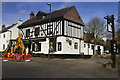
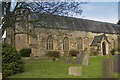
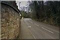
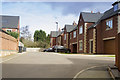
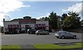
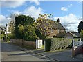
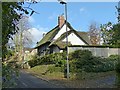
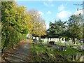
100 photos from this area
Area Information
Key information about the DE23 6DT including its size, population, and administrative classification.
- Area Type
- Postcode
- Area Size
- 8297 m²
- Population
- 2365
- Population Density
- 2188 people/km²
House Prices in DE23 6DT
25
Properties
£186,940
Average Sold Price
£86,000
Lowest Price
£326,000
Highest Price
Showing 25 properties
| Address | Type | Beds | Baths | Last Sale Price | Last Sale Date | |
|---|---|---|---|---|---|---|
| 18 Queens Drive, Derby, DE23 6DT | Detached | 3 | 1 | £326,000 | Aug 2025 | |
| 28 Queens Drive, Derby, DE23 6DT | house | - | - | £247,500 | Aug 2021 | |
| 38 Queens Drive, Derby, DE23 6DT | Semi-detached | 3 | 1 | £230,000 | Nov 2020 | |
| 14 Queens Drive, Derby, DE23 6DT | Detached | 3 | 1 | £240,000 | Sep 2018 | |
| 6 Queens Drive, Derby, DE23 6DT | Semi-detached | 3 | 1 | £158,000 | Jun 2017 | |
| 50 Queens Drive, Derby, DE23 6DT | house | - | - | £189,000 | Jul 2015 | |
| 34 Queens Drive, Derby, DE23 6DT | house | - | - | £170,000 | Feb 2014 | |
| 30 Queens Drive, Derby, DE23 6DT | house | 3 | - | £177,000 | Jul 2013 | |
| 44 Queens Drive, Derby, DE23 6DT | house | - | - | £174,000 | May 2012 | |
| 32 Queens Drive, Derby, DE23 6DT | house | - | - | £175,000 | Aug 2009 |
Page 1 of 3
Energy Efficiency in DE23 6DT
Amenities
Schools
| Rank | School | Type | Entry gender | Ages |
|---|
Explore more schools in this area
Go to Schools tabDemographics
Household Size
Two person
most common
Accommodation Type
Houses
most common
Tenure
59
majority
Ethnic Group
White
most common
Religion
N/A
most common
Household Composition
N/A
most common
Age
47
median
Adults (30-64 years)
most common
Household Deprivation
N/A
with no deprivation
NS-SEC
41
in Lower managerial occupations
Explore more demographic insights in this area
Go to Demographics tabPlanning
Planning Constraints
- Flood RiskPremium
- Ramsar Wetland SitesPremium
- Area of Outstanding Natural BeautyPremium
- Protected Nature ReservePremium
- Protected WoodlandPremium