Area Overview for DE23 6DH
Photos of DE23 6DH
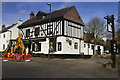
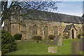
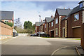
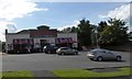
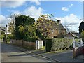
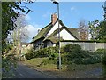
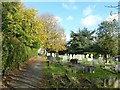
100 photos from this area
Area Information
Key information about the DE23 6DH including its size, population, and administrative classification.
- Area Type
- Postcode
- Area Size
- 1.2 hectares
- Population
- 2365
- Population Density
- 2188 people/km²
House Prices in DE23 6DH
19
Properties
£261,182
Average Sold Price
£100,000
Lowest Price
£532,000
Highest Price
Showing 19 properties
| Address | Type | Beds | Baths | Last Sale Price | Last Sale Date | |
|---|---|---|---|---|---|---|
| 602 Burton Road, Derby, DE23 6DH | Retail | 4 | 2 | £532,000 | Feb 2022 | |
| 612 Burton Road, Derby, DE23 6DH | house | - | - | £380,500 | Oct 2021 | |
| 606A Burton Road, Derby, DE23 6DH | Detached | 4 | 1 | £359,000 | Feb 2021 | |
| 594 Burton Road, Derby, DE23 6DH | house | - | - | £255,000 | May 2016 | |
| 622 Burton Road, Derby, DE23 6DH | Bungalow | - | - | £280,000 | Jul 2009 | |
| 598 Burton Road, Derby, DE23 6DH | Semi-detached | 3 | - | £220,000 | Feb 2008 | |
| 610 Burton Road, Derby, DE23 6DH | Detached | - | - | £337,500 | Dec 2007 | |
| 618 Burton Road, Derby, DE23 6DH | Semi-detached | - | - | £170,000 | Sep 2002 | |
| 620 Burton Road, Derby, DE23 6DH | house | - | - | £135,000 | Feb 2002 | |
| 608 Burton Road, Derby, DE23 6DH | Detached | 3 | 1 | £100,000 | Jun 1998 |
Page 1 of 2
Energy Efficiency in DE23 6DH
Amenities
Schools
| Rank | School | Type | Entry gender | Ages |
|---|
Explore more schools in this area
Go to Schools tabDemographics
Household Size
Two person
most common
Accommodation Type
Houses
most common
Tenure
59
majority
Ethnic Group
White
most common
Religion
N/A
most common
Household Composition
N/A
most common
Age
47
median
Adults (30-64 years)
most common
Household Deprivation
N/A
with no deprivation
NS-SEC
41
in Lower managerial occupations
Explore more demographic insights in this area
Go to Demographics tabPlanning
Planning Constraints
- Flood RiskPremium
- Ramsar Wetland SitesPremium
- Area of Outstanding Natural BeautyPremium
- Protected Nature ReservePremium
- Protected WoodlandPremium