Area Overview for DE23 6AF
Photos of DE23 6AF
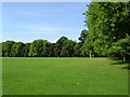
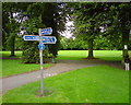
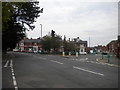
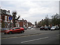
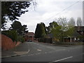
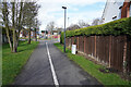
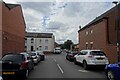
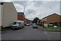
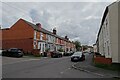
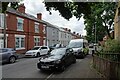
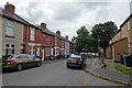
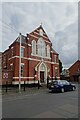
33 photos from this area
Area Information
Key information about the DE23 6AF including its size, population, and administrative classification.
- Area Type
- Postcode
- Area Size
- 2.7 hectares
- Population
- 1768
- Population Density
- 7249 people/km²
House Prices in DE23 6AF
22
Properties
£220,917
Average Sold Price
£26,000
Lowest Price
£355,000
Highest Price
Showing 22 properties
| Address | Type | Beds | Baths | Last Sale Price | Last Sale Date | |
|---|---|---|---|---|---|---|
| 404 Burton Road, Derby, DE23 6AF | house | - | - | £280,000 | Jan 2025 | |
| 402 Burton Road, Derby, DE23 6AF | Detached | 4 | 1 | £265,000 | Dec 2019 | |
| 348 Burton Road, Derby, DE23 6AF | Bungalow | 5 | - | £355,000 | Dec 2014 | |
| 394 Burton Road, Derby, DE23 6AF | house | - | - | £250,000 | Jul 2014 | |
| 398 Burton Road, Derby, DE23 6AF | house | 6 | - | £275,000 | May 2013 | |
| 388 Burton Road, Derby, DE23 6AF | house | 3 | - | £180,000 | Apr 2013 | |
| 318 Burton Road, Derby, DE23 6AF | house | - | - | £160,000 | Sep 2010 | |
| 358 Burton Road, Derby, DE23 6AF | Detached | 5 | 3 | £290,000 | Jun 2006 | |
| 392 Burton Road, Derby, DE23 6AF | Detached | 4 | 1 | £197,000 | Mar 2004 | |
| 316 Burton Road, Derby, DE23 6AF | Detached | 5 | - | £220,000 | May 2003 |
Page 1 of 3
Energy Efficiency in DE23 6AF
Amenities
Schools
| Rank | School | Type | Entry gender | Ages |
|---|
Explore more schools in this area
Go to Schools tabDemographics
Household Size
Two person
most common
Accommodation Type
Houses
most common
Tenure
39
majority
Ethnic Group
White
most common
Religion
N/A
most common
Household Composition
N/A
most common
Age
47
median
Adults (30-64 years)
most common
Household Deprivation
N/A
with no deprivation
NS-SEC
25
in Lower managerial occupations
Explore more demographic insights in this area
Go to Demographics tabPlanning
Planning Constraints
- Flood RiskPremium
- Ramsar Wetland SitesPremium
- Area of Outstanding Natural BeautyPremium
- Protected Nature ReservePremium
- Protected WoodlandPremium