Area Overview for DE23 4AT
Photos of DE23 4AT
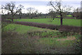
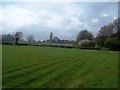
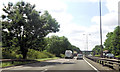
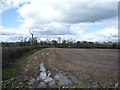
18 photos from this area
Area Information
Key information about the DE23 4AT including its size, population, and administrative classification.
- Area Type
- Postcode
- Area Size
- 3.6 hectares
- Population
- 1790
- Population Density
- 2469 people/km²
House Prices in DE23 4AT
13
Properties
£208,495
Average Sold Price
£135,000
Lowest Price
£265,000
Highest Price
Showing 13 properties
| Address | Type | Beds | Baths | Last Sale Price | Last Sale Date | |
|---|---|---|---|---|---|---|
| 5 Rykneld Way, Derby, DE23 4AT | Semi-detached | 4 | 1 | £240,000 | Jan 2021 | |
| 15 Rykneld Way, Derby, DE23 4AT | Detached | 3 | 1 | £248,000 | Dec 2020 | |
| 1 Rykneld Way, Derby, DE23 4AT | Bungalow | 2 | 1 | £201,000 | Apr 2018 | |
| 21 Rykneld Way, Derby, DE23 4AT | Detached | 2 | 1 | £140,000 | Mar 2017 | |
| 3 Rykneld Way, Derby, DE23 4AT | Semi-detached | 3 | 1 | £227,000 | Feb 2017 | |
| 17 Rykneld Way, Derby, DE23 4AT | Bungalow | 3 | 2 | £265,000 | Nov 2015 | |
| 19 Rykneld Way, Derby, DE23 4AT | Bungalow | - | - | £195,000 | Jan 2013 | |
| 23 Rykneld Way, Derby, DE23 4AT | house | 3 | - | £204,000 | Feb 2011 | |
| 25 Rykneld Way, Derby, DE23 4AT | Detached | - | - | £229,950 | Aug 2004 | |
| 11 Rykneld Way, Derby, DE23 4AT | Semi-detached | 3 | 1 | £135,000 | Nov 2003 |
Page 1 of 2
Energy Efficiency in DE23 4AT
Amenities
Schools
| Rank | School | Type | Entry gender | Ages |
|---|
Explore more schools in this area
Go to Schools tabDemographics
Household Size
Family (3-5 people)
most common
Accommodation Type
Houses
most common
Tenure
56
majority
Ethnic Group
White
most common
Religion
N/A
most common
Household Composition
N/A
most common
Age
47
median
Adults (30-64 years)
most common
Household Deprivation
N/A
with no deprivation
NS-SEC
34
in Lower managerial occupations
Explore more demographic insights in this area
Go to Demographics tabPlanning
Planning Constraints
- Flood RiskPremium
- Ramsar Wetland SitesPremium
- Area of Outstanding Natural BeautyPremium
- Protected Nature ReservePremium
- Protected WoodlandPremium