Area Overview for DE23 3UW
Photos of DE23 3UW
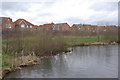
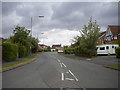
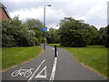
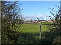
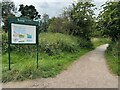
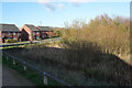
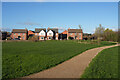
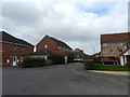
19 photos from this area
Area Information
Key information about the DE23 3UW including its size, population, and administrative classification.
- Area Type
- Postcode
- Area Size
- 8263 m²
- Population
- 2331
- Population Density
- 5401 people/km²
House Prices in DE23 3UW
15
Properties
£335,321
Average Sold Price
£225,950
Lowest Price
£442,500
Highest Price
Showing 15 properties
| Address | Type | Beds | Baths | Last Sale Price | Last Sale Date | |
|---|---|---|---|---|---|---|
| 9 Nettleton Close, Derby, DE23 3UW | Detached | 4 | 2 | £368,000 | May 2021 | |
| 6 Nettleton Close, Derby, DE23 3UW | house | - | - | £384,500 | Jan 2020 | |
| 3 Nettleton Close, Derby, DE23 3UW | Detached | 4 | 1 | £325,000 | Nov 2018 | |
| 14 Nettleton Close, Derby, DE23 3UW | Detached | - | - | £352,500 | Aug 2015 | |
| 2 Nettleton Close, Derby, DE23 3UW | Detached | 5 | 4 | £442,500 | Dec 2014 | |
| 1 Nettleton Close, Derby, DE23 3UW | Detached | 5 | 3 | £263,250 | Aug 2013 | |
| 16 Nettleton Close, Derby, DE23 3UW | Detached | 5 | 3 | £345,000 | Jun 2011 | |
| 10 Nettleton Close, Derby, DE23 3UW | Detached | - | - | £365,000 | Jun 2008 | |
| 11 Nettleton Close, Derby, DE23 3UW | Detached | - | - | £273,000 | Apr 2008 | |
| 18 Nettleton Close, Derby, DE23 3UW | Detached | - | - | £234,950 | Oct 2005 |
Page 1 of 2
Energy Efficiency in DE23 3UW
Amenities
Schools
| Rank | School | Type | Entry gender | Ages |
|---|
Explore more schools in this area
Go to Schools tabDemographics
Household Size
Family (3-5 people)
most common
Accommodation Type
Houses
most common
Tenure
89
majority
Ethnic Group
asian_total
most common
Religion
N/A
most common
Household Composition
N/A
most common
Age
47
median
Adults (30-64 years)
most common
Household Deprivation
N/A
with no deprivation
NS-SEC
47
in Lower managerial occupations
Explore more demographic insights in this area
Go to Demographics tabPlanning
Planning Constraints
- Flood RiskPremium
- Ramsar Wetland SitesPremium
- Area of Outstanding Natural BeautyPremium
- Protected Nature ReservePremium
- Protected WoodlandPremium