Area Overview for DE23 2FS
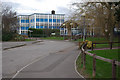
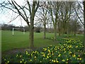
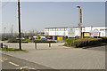
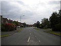
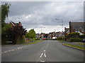
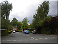
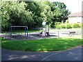
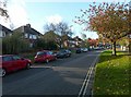
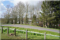
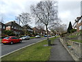
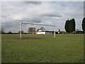
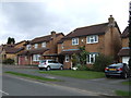
Photos of DE23 2FS
Area Information
Living in DE23 2FS means inhabiting a compact, densely populated residential cluster in England. The area spans just 4.4 hectares, housing 1,547 people across a population density of 35,540 per square kilometre. This suggests a tightly knit community, where proximity to neighbours is a defining feature. The area’s small size and high density make it ideal for those seeking a quiet, localised environment with minimal commuting. While the postcode is not near major cities, it benefits from nearby rail connections and a range of amenities within practical reach. The demographic profile—predominantly adults aged 30–64—hints at a stable, family-oriented population, with 77% owning their homes. This mix of characteristics creates a distinctive balance between urban convenience and residential tranquillity, offering a snapshot of suburban life in a compact, well-served postcode.
- Area Type
- Postcode
- Area Size
- 4.4 hectares
- Population
- 1547
- Population Density
- 2755 people/km²
DE23 2FS is characterised by a strong owner-occupied market, with 77% of properties owned by residents rather than rented. The accommodation type is predominantly houses, which is unusual for a densely populated area. This suggests a mix of larger, standalone homes and possibly semi-detached properties, catering to families or individuals seeking more space. The high home ownership rate indicates a stable market with limited turnover, which may appeal to buyers seeking long-term investment. However, the small area size—just 4.4 hectares—means the housing stock is limited, potentially restricting availability. For buyers, this could mean competition for properties, though the focus on owner-occupied homes may reduce the presence of short-term rentals. The predominance of houses also implies a preference for private, low-density living, which may align with the area’s overall character.
House Prices in DE23 2FS
No properties found in this postcode.
Energy Efficiency in DE23 2FS
Daily life in DE23 2FS is shaped by its proximity to retail and transport hubs. Local shops include Co-op Heatherton, Co-op Tutbury, and Aldi Rykneld, offering essential goods within walking distance. The area’s rail stations—Peartree, Derby, and Willington—provide links to nearby towns and cities, though the exact travel times are not specified. While the postcode itself is small, the surrounding area likely includes parks or green spaces, though specific names are not listed. The compact layout means amenities are accessible without excessive travel, fostering a self-contained lifestyle. For residents, this balance of retail, transport, and proximity to schools creates a practical, community-focused environment, ideal for those prioritising convenience over expansive leisure options.
Amenities
Schools
Residents of DE23 2FS have access to a range of educational institutions, from early years to sixth-form levels. Carlyle Infant and Nursery School and Derby Moor Community Sports College cater to primary education, while Ivy House School provides specialist support for students with specific needs. The Millennium Centre offers sixth-form education, and Derby Moor Spencer Academy operates as an academy. This mix ensures families can access education at every stage without needing to travel far. The presence of both mainstream and specialist schools reflects a commitment to inclusive learning, though the absence of Ofsted ratings means performance insights are not available. For parents, the variety of school types offers flexibility, whether prioritising traditional education or tailored support for children with additional needs.
| Rank | School | Type | Entry gender | Ages |
|---|
Explore more schools in this area
Go to Schools tabDemographics
DE23 2FS has a median age of 47, with the majority of residents falling into the 30–64 age bracket. This suggests a mature, established community with a strong focus on long-term stability. Home ownership is high at 77%, indicating a preference for settled living over rental tenancies. The area is predominantly White, with no data provided on other ethnic groups. The high population density—35,540 people per square kilometre—reflects a tightly packed residential layout, which may influence social dynamics and local infrastructure. For families, the presence of schools ranging from primary to sixth-form levels offers continuity in education. The demographic profile aligns with a community prioritising security, familiarity, and proximity to essential services, though the lack of specific data on diversity means broader cultural insights remain unexplored.
Household Size
Accommodation Type
Tenure
Ethnic Group
Religion
Household Composition
Age
Household Deprivation
NS-SEC
Explore more demographic insights in this area
Go to Demographics tabPlanning
Planning Constraints
- Flood RiskPremium
- Ramsar Wetland SitesPremium
- Area of Outstanding Natural BeautyPremium
- Protected Nature ReservePremium
- Protected WoodlandPremium