Area Overview for DE22 4EG
Photos of DE22 4EG
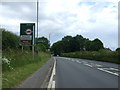
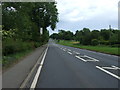
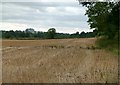
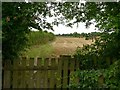
53 photos from this area
Area Information
Key information about the DE22 4EG including its size, population, and administrative classification.
- Area Type
- Postcode
- Area Size
- 2.8 hectares
- Population
- 1548
- Population Density
- 4687 people/km²
House Prices in DE22 4EG
25
Properties
£137,324
Average Sold Price
£57,000
Lowest Price
£260,000
Highest Price
Showing 25 properties
| Address | Type | Beds | Baths | Last Sale Price | Last Sale Date | |
|---|---|---|---|---|---|---|
| 23 Woodford Road, Derby, DE22 4EG | Detached | 4 | 2 | £260,000 | Oct 2021 | |
| 29 Woodford Road, Derby, DE22 4EG | Bungalow | - | - | £185,000 | May 2021 | |
| 27 Woodford Road, Derby, DE22 4EG | Detached | 3 | - | £220,000 | Jun 2019 | |
| 19 Woodford Road, Derby, DE22 4EG | Bungalow | 4 | - | £210,000 | Dec 2015 | |
| 58 Woodford Road, Derby, DE22 4EG | house | - | - | £203,000 | May 2014 | |
| 78 Woodford Road, Derby, DE22 4EG | house | 3 | - | £160,000 | Sep 2010 | |
| 66 Woodford Road, Derby, DE22 4EG | house | - | - | £162,500 | Mar 2010 | |
| 43 Woodford Road, Derby, DE22 4EG | Detached | - | - | £170,000 | Oct 2009 | |
| 80 Woodford Road, Derby, DE22 4EG | Detached | - | - | £146,500 | Aug 2002 | |
| 45 Woodford Road, Derby, DE22 4EG | Detached | 3 | - | £83,000 | Mar 2001 |
Page 1 of 3
Energy Efficiency in DE22 4EG
Amenities
Schools
| Rank | School | Type | Entry gender | Ages |
|---|
Explore more schools in this area
Go to Schools tabDemographics
Household Size
Family (3-5 people)
most common
Accommodation Type
Houses
most common
Tenure
65
majority
Ethnic Group
White
most common
Religion
N/A
most common
Household Composition
N/A
most common
Age
47
median
Adults (30-64 years)
most common
Household Deprivation
N/A
with no deprivation
NS-SEC
22
in Lower managerial occupations
Explore more demographic insights in this area
Go to Demographics tabPlanning
Planning Constraints
- Flood RiskPremium
- Ramsar Wetland SitesPremium
- Area of Outstanding Natural BeautyPremium
- Protected Nature ReservePremium
- Protected WoodlandPremium