Area Overview for DE22 3XB
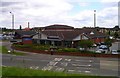
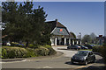
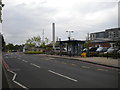
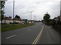
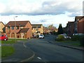
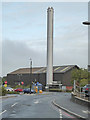
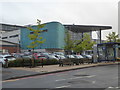
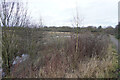
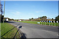
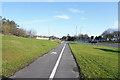
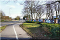
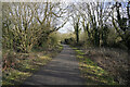
Photos of DE22 3XB
Area Information
Living in DE22 3XB means inhabiting a compact, residential postcode area in Derby, England, where 2,365 people reside across 8.5 hectares. This small cluster, part of the Abbey electoral ward, includes parts of California, Rowditch, and St Lukes. The area’s density—2,188 people per square kilometre—reflects its tightly knit character, with homes predominantly in private ownership. Despite its size, DE22 3XB is steeped in history, home to 15 listed buildings, including No. 48 Bedford Street, a former vicarage dating to 1895. Daily life here balances proximity to Derby’s urban amenities with a quieter, residential rhythm. The postcode’s limited footprint means residents are close to key services, rail links, and retail hubs, though its small scale also means community ties are visibly strong. For those seeking a blend of heritage and practicality, DE22 3XB offers a snapshot of Derby’s evolving urban fabric, where listed architecture meets modern living.
- Area Type
- Postcode
- Area Size
- 8.5 hectares
- Population
- 2365
- Population Density
- 2188 people/km²
DE22 3XB is primarily an owner-occupied area, with 59% of homes in private hands, contrasting with a 41% rental market share. The accommodation type is exclusively houses, not flats or apartments, reflecting a preference for single-family residences. This makes the area distinct from denser urban zones, where rental properties dominate. The small size of the postcode—8.5 hectares—means the housing stock is limited, with a high population density of 2,188 people per square kilometre. For buyers, this suggests a niche market where properties are likely to be in established, mature homes rather than new developments. The proximity to Derby’s rail network and retail hubs adds practical value, though the area’s compact nature means buyers must consider nearby suburbs for broader options. The focus on owner-occupied housing also indicates a community where long-term residency is common, potentially offering stability for new buyers.
House Prices in DE22 3XB
No properties found in this postcode.
Energy Efficiency in DE22 3XB
Residents of DE22 3XB have access to a range of nearby amenities, including five retail outlets such as Aldi St, M&S Royal, and Sainsburys Kingsway. These shops provide essential grocery and retail services within walking or short driving distance. The area’s proximity to Derby’s rail network also opens access to the city’s cultural and leisure offerings, from museums to parks. While the postcode itself is small, its integration with Derby’s urban infrastructure means residents can enjoy the city’s vibrancy without sacrificing residential tranquillity. The presence of listed buildings and historic sites, such as St Lukes Church, adds a layer of heritage to daily life, blending practicality with character. For families, the combination of local shops, rail links, and nearby green spaces offers a balanced lifestyle, with convenience and community at its core.
Amenities
Schools
| Rank | School | Type | Entry gender | Ages |
|---|
Explore more schools in this area
Go to Schools tabDemographics
The population of DE22 3XB skews towards adults aged 30–64, with a median age of 47, reflecting a mature, established community. Home ownership here is robust, with 59% of residents living in their own homes, compared to 41% renting. The area is predominantly composed of houses, not flats, aligning with the demographic profile of older, settled households. The predominant ethnic group is White, with no specific data on minority representation. This age group’s presence suggests a stable, low-turnover environment, where families and long-term residents form the core of the community. The high population density—2,188 people per square kilometre—means the area is compact but not overcrowded, with housing stock tailored to single-family living. This demographic structure implies a focus on comfort and permanence, with limited pressure from transient populations or student demographics.
Household Size
Accommodation Type
Tenure
Ethnic Group
Religion
Household Composition
Age
Household Deprivation
NS-SEC
Explore more demographic insights in this area
Go to Demographics tabPlanning
Planning Constraints
- Flood RiskPremium
- Ramsar Wetland SitesPremium
- Area of Outstanding Natural BeautyPremium
- Protected Nature ReservePremium
- Protected WoodlandPremium