Area Overview for DE22 3QW
Photos of DE22 3QW
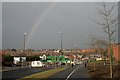
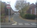
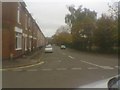
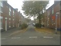
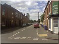
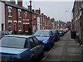
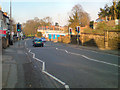
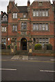
100 photos from this area
Area Information
Key information about the DE22 3QW including its size, population, and administrative classification.
- Area Type
- Postcode
- Area Size
- 1.0 hectares
- Population
- 2293
- Population Density
- 4794 people/km²
House Prices in DE22 3QW
15
Properties
£70,817
Average Sold Price
£47,500
Lowest Price
£89,950
Highest Price
Showing 15 properties
| Address | Type | Beds | Baths | Last Sale Price | Last Sale Date | |
|---|---|---|---|---|---|---|
| 257 Drewry Lane, Derby, DE22 3QW | house | 2 | - | £89,950 | Aug 2022 | |
| 259 Drewry Lane, Derby, DE22 3QW | Terraced | 2 | 2 | £75,000 | Nov 2013 | |
| 255 Drewry Lane, Derby, DE22 3QW | Terraced | 2 | 2 | £47,500 | Jul 2005 | |
| 279 Drewry Lane, Derby, DE22 3QW | Bungalow | - | - | - | - | |
| 269 Drewry Lane, Derby, DE22 3QW | Bungalow | - | - | - | - | |
| 273 Drewry Lane, Derby, DE22 3QW | house | - | - | - | - | |
| 265 Drewry Lane, Derby, DE22 3QW | Bungalow | - | - | - | - | |
| 261 Drewry Lane, Derby, DE22 3QW | Bungalow | - | - | - | - | |
| 277 Drewry Lane, Derby, DE22 3QW | Bungalow | - | - | - | - | |
| 275 Drewry Lane, Derby, DE22 3QW | Bungalow | - | - | - | - |
Page 1 of 2
Energy Efficiency in DE22 3QW
Amenities
Schools
| Rank | School | Type | Entry gender | Ages |
|---|
Explore more schools in this area
Go to Schools tabDemographics
Household Size
One person
most common
Accommodation Type
Houses
most common
Tenure
24
majority
Ethnic Group
White
most common
Religion
N/A
most common
Household Composition
N/A
most common
Age
47
median
Adults (30-64 years)
most common
Household Deprivation
N/A
with no deprivation
NS-SEC
25
in Lower managerial occupations
Explore more demographic insights in this area
Go to Demographics tabPlanning
Planning Constraints
- Flood RiskPremium
- Ramsar Wetland SitesPremium
- Area of Outstanding Natural BeautyPremium
- Protected Nature ReservePremium
- Protected WoodlandPremium