Area Overview for DE22 3QU
Photos of DE22 3QU
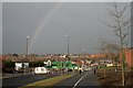
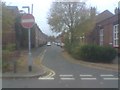
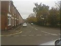
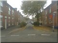
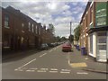
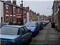
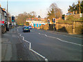
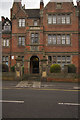
100 photos from this area
Area Information
Key information about the DE22 3QU including its size, population, and administrative classification.
- Area Type
- Postcode
- Area Size
- 8395 m²
- Population
- 1782
- Population Density
- 10062 people/km²
House Prices in DE22 3QU
53
Properties
£94,717
Average Sold Price
£28,250
Lowest Price
£185,000
Highest Price
Showing 53 properties
| Address | Type | Beds | Baths | Last Sale Price | Last Sale Date | |
|---|---|---|---|---|---|---|
| 98 Drewry Lane, Derby, DE22 3QU | Detached | 3 | 1 | £123,000 | Feb 2025 | |
| 132 Drewry Lane, Derby, DE22 3QU | Terraced | 6 | 6 | £185,000 | Oct 2024 | |
| 96 Drewry Lane, Derby, DE22 3QU | Terraced | 2 | 2 | £155,000 | Dec 2023 | |
| 134 Drewry Lane, Derby, DE22 3QU | Flat | 6 | 1 | £146,250 | Mar 2023 | |
| 142 Drewry Lane, Derby, DE22 3QU | Terraced | 2 | - | £120,000 | Oct 2021 | |
| 88 Drewry Lane, Derby, DE22 3QU | house | - | - | £85,000 | Feb 2021 | |
| 126 Drewry Lane, Derby, DE22 3QU | Terraced | - | - | £90,000 | Nov 2020 | |
| 130 Drewry Lane, Derby, DE22 3QU | house | 1 | - | £95,000 | May 2019 | |
| 150 Drewry Lane, Derby, DE22 3QU | Semi-detached | 3 | 1 | £146,000 | Apr 2019 | |
| 94 Drewry Lane, Derby, DE22 3QU | Terraced | 2 | 1 | £104,000 | Oct 2018 |
Page 1 of 6
Energy Efficiency in DE22 3QU
Amenities
Schools
| Rank | School | Type | Entry gender | Ages |
|---|
Explore more schools in this area
Go to Schools tabDemographics
Household Size
One person
most common
Accommodation Type
Houses
most common
Tenure
20
majority
Ethnic Group
White
most common
Religion
N/A
most common
Household Composition
N/A
most common
Age
22
median
Young Adults (15-29 years)
most common
Household Deprivation
N/A
with no deprivation
NS-SEC
23
in Lower managerial occupations
Explore more demographic insights in this area
Go to Demographics tabPlanning
Planning Constraints
- Flood RiskPremium
- Ramsar Wetland SitesPremium
- Area of Outstanding Natural BeautyPremium
- Protected Nature ReservePremium
- Protected WoodlandPremium