Area Overview for DE22 3GY
Photos of DE22 3GY
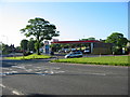

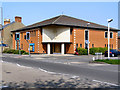
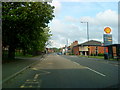
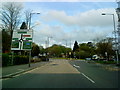


69 photos from this area
Area Information
Key information about the DE22 3GY including its size, population, and administrative classification.
- Area Type
- Postcode
- Area Size
- 7253 m²
- Population
- 1269
- Population Density
- 5729 people/km²
House Prices in DE22 3GY
48
Properties
£72,557
Average Sold Price
£27,400
Lowest Price
£95,000
Highest Price
Showing 48 properties
| Address | Type | Beds | Baths | Last Sale Price | Last Sale Date | |
|---|---|---|---|---|---|---|
| 99 Cobden Street, Derby, DE22 3GY | Flat | - | - | £82,000 | May 2022 | |
| 117 Cobden Street, Derby, DE22 3GY | Flat | - | - | £65,000 | Jul 2019 | |
| 111 Cobden Street, Derby, DE22 3GY | Flat | - | - | £92,500 | Mar 2016 | |
| 45 Cobden Street, Derby, DE22 3GY | Flat | - | - | £80,000 | Feb 2015 | |
| 101 Cobden Street, Derby, DE22 3GY | Flat | - | - | £66,000 | Feb 2009 | |
| 43 Cobden Street, Derby, DE22 3GY | Flat | 2 | 1 | £95,000 | May 2007 | |
| 133 Cobden Street, Derby, DE22 3GY | Flat | - | - | £27,400 | Sep 2003 | |
| 83 Cobden Street, Derby, DE22 3GY | Maisonette | - | - | - | - | |
| 91 Cobden Street, Derby, DE22 3GY | Flat | - | - | - | - | |
| 57 Cobden Street, Derby, DE22 3GY | Maisonette | - | - | - | - |
Page 1 of 5
Energy Efficiency in DE22 3GY
Amenities
Schools
| Rank | School | Type | Entry gender | Ages |
|---|
Explore more schools in this area
Go to Schools tabDemographics
Household Size
Family (3-5 people)
most common
Accommodation Type
Houses
most common
Tenure
46
majority
Ethnic Group
White
most common
Religion
N/A
most common
Household Composition
N/A
most common
Age
47
median
Adults (30-64 years)
most common
Household Deprivation
N/A
with no deprivation
NS-SEC
20
in Lower managerial occupations
Explore more demographic insights in this area
Go to Demographics tabPlanning
Planning Constraints
- Flood RiskPremium
- Ramsar Wetland SitesPremium
- Area of Outstanding Natural BeautyPremium
- Protected Nature ReservePremium
- Protected WoodlandPremium