Area Overview for DE22 3AY
Photos of DE22 3AY
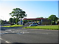

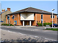
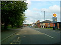
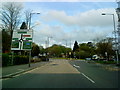
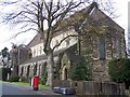
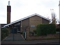

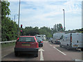


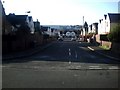
69 photos from this area
Area Information
Key information about the DE22 3AY including its size, population, and administrative classification.
- Area Type
- Postcode
- Area Size
- 4676 m²
- Population
- 1829
- Population Density
- 9399 people/km²
House Prices in DE22 3AY
20
Properties
£188,915
Average Sold Price
£124,950
Lowest Price
£247,000
Highest Price
Showing 20 properties
| Address | Type | Beds | Baths | Last Sale Price | Last Sale Date | |
|---|---|---|---|---|---|---|
| 16, St Katherines Court, Bass Street, Derby, DE22 3AY | Semi-detached | 3 | 1 | £225,000 | Dec 2024 | |
| 5, St Katherines Court, Bass Street, Derby, DE22 3AY | Semi-detached | 3 | 1 | £230,000 | Jul 2024 | |
| 3, St Katherines Court, Bass Street, Derby, DE22 3AY | Semi-detached | 1 | 1 | £247,000 | Mar 2024 | |
| 20, St Katherines Court, Bass Street, Derby, DE22 3AY | Semi-detached | 3 | 1 | £240,000 | Sep 2022 | |
| 6, St Katherines Court, Bass Street, Derby, DE22 3AY | house | - | - | £187,000 | Feb 2021 | |
| 4, St Katherines Court, Bass Street, Derby, DE22 3AY | Semi-detached | 1 | 1 | £229,000 | Jul 2020 | |
| 8, St Katherines Court, Bass Street, Derby, DE22 3AY | Semi-detached | 4 | 2 | £195,000 | Sep 2019 | |
| 1, St Katherines Court, Bass Street, Derby, DE22 3AY | Semi-detached | 4 | 2 | £205,000 | Jul 2017 | |
| 19, St Katherines Court, Bass Street, Derby, DE22 3AY | Semi-detached | 3 | 1 | £189,950 | May 2016 | |
| 14, St Katherines Court, Bass Street, Derby, DE22 3AY | Semi-detached | 4 | 2 | £185,000 | Feb 2016 |
Page 1 of 2
Energy Efficiency in DE22 3AY
Amenities
Schools
| Rank | School | Type | Entry gender | Ages |
|---|
Explore more schools in this area
Go to Schools tabDemographics
Household Size
One person
most common
Accommodation Type
Houses
most common
Tenure
32
majority
Ethnic Group
White
most common
Religion
N/A
most common
Household Composition
N/A
most common
Age
22
median
Young Adults (15-29 years)
most common
Household Deprivation
N/A
with no deprivation
NS-SEC
22
in Lower managerial occupations
Explore more demographic insights in this area
Go to Demographics tabPlanning
Planning Constraints
- Flood RiskPremium
- Ramsar Wetland SitesPremium
- Area of Outstanding Natural BeautyPremium
- Protected Nature ReservePremium
- Protected WoodlandPremium