Area Overview for DE22 2HQ
Photos of DE22 2HQ
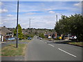
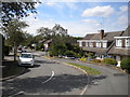
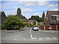
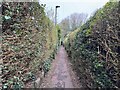
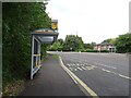
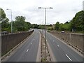
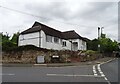
30 photos from this area
Area Information
Key information about the DE22 2HQ including its size, population, and administrative classification.
- Area Type
- Postcode
- Area Size
- 2.1 hectares
- Population
- 1406
- Population Density
- 4126 people/km²
House Prices in DE22 2HQ
38
Properties
£236,250
Average Sold Price
£81,500
Lowest Price
£347,000
Highest Price
Showing 38 properties
| Address | Type | Beds | Baths | Last Sale Price | Last Sale Date | |
|---|---|---|---|---|---|---|
| 29 Allestree Lane, Derby, DE22 2HQ | Semi-detached | 3 | 1 | £320,000 | Oct 2024 | |
| 23 Allestree Lane, Derby, DE22 2HQ | house | - | - | £280,000 | Nov 2022 | |
| 35 Allestree Lane, Derby, DE22 2HQ | house | - | - | £347,000 | Sep 2021 | |
| 69 Allestree Lane, Derby, DE22 2HQ | house | - | - | £346,750 | Apr 2021 | |
| 73 Allestree Lane, Derby, DE22 2HQ | house | - | - | £300,000 | Mar 2021 | |
| 19 Allestree Lane, Derby, DE22 2HQ | house | 4 | 2 | £340,000 | Jan 2021 | |
| 71 Allestree Lane, Derby, DE22 2HQ | Semi-detached | 5 | 1 | £287,500 | Sep 2018 | |
| 65 Allestree Lane, Derby, DE22 2HQ | house | - | - | £225,000 | Feb 2017 | |
| 61 Allestree Lane, Derby, DE22 2HQ | house | - | - | £230,000 | Nov 2016 | |
| 15 Allestree Lane, Derby, DE22 2HQ | Semi-detached | 3 | 2 | £285,000 | Jun 2016 |
Page 1 of 4
Energy Efficiency in DE22 2HQ
Amenities
Schools
| Rank | School | Type | Entry gender | Ages |
|---|
Explore more schools in this area
Go to Schools tabDemographics
Household Size
Two person
most common
Accommodation Type
Houses
most common
Tenure
87
majority
Ethnic Group
White
most common
Religion
N/A
most common
Household Composition
N/A
most common
Age
47
median
Adults (30-64 years)
most common
Household Deprivation
N/A
with no deprivation
NS-SEC
43
in Lower managerial occupations
Explore more demographic insights in this area
Go to Demographics tabPlanning
Planning Constraints
- Flood RiskPremium
- Ramsar Wetland SitesPremium
- Area of Outstanding Natural BeautyPremium
- Protected Nature ReservePremium
- Protected WoodlandPremium