Area Overview for DE22 2GT
Photos of DE22 2GT
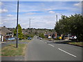
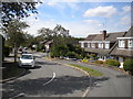
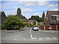
30 photos from this area
Area Information
Key information about the DE22 2GT including its size, population, and administrative classification.
- Area Type
- Postcode
- Area Size
- 6593 m²
- Population
- 1406
- Population Density
- 4126 people/km²
House Prices in DE22 2GT
14
Properties
£187,900
Average Sold Price
£60,000
Lowest Price
£280,000
Highest Price
Showing 14 properties
| Address | Type | Beds | Baths | Last Sale Price | Last Sale Date | |
|---|---|---|---|---|---|---|
| 103 Laburnum Crescent, Derby, DE22 2GT | Bungalow | 2 | 1 | £204,000 | Aug 2024 | |
| 118 Laburnum Crescent, Derby, DE22 2GT | Bungalow | - | - | £230,000 | Oct 2020 | |
| 120 Laburnum Crescent, Derby, DE22 2GT | Bungalow | 3 | 1 | £280,000 | Feb 2020 | |
| 101 Laburnum Crescent, Derby, DE22 2GT | Bungalow | 2 | 1 | £215,000 | Sep 2019 | |
| 107 Laburnum Crescent, Derby, DE22 2GT | Bungalow | - | - | £199,000 | Jul 2015 | |
| 99 Laburnum Crescent, Derby, DE22 2GT | Bungalow | - | - | £155,000 | May 2014 | |
| 109 Laburnum Crescent, Derby, DE22 2GT | house | 3 | - | £210,000 | Oct 2013 | |
| 97 Laburnum Crescent, Derby, DE22 2GT | Detached | - | - | £146,000 | Jan 2008 | |
| 116 Laburnum Crescent, Derby, DE22 2GT | house | - | - | £180,000 | Oct 2004 | |
| 122 Laburnum Crescent, Derby, DE22 2GT | Bungalow | 2 | 1 | £60,000 | Jan 1998 |
Page 1 of 2
Energy Efficiency in DE22 2GT
Amenities
Schools
| Rank | School | Type | Entry gender | Ages |
|---|
Explore more schools in this area
Go to Schools tabDemographics
Household Size
Two person
most common
Accommodation Type
Houses
most common
Tenure
87
majority
Ethnic Group
White
most common
Religion
N/A
most common
Household Composition
N/A
most common
Age
47
median
Adults (30-64 years)
most common
Household Deprivation
N/A
with no deprivation
NS-SEC
43
in Lower managerial occupations
Explore more demographic insights in this area
Go to Demographics tabPlanning
Planning Constraints
- Flood RiskPremium
- Ramsar Wetland SitesPremium
- Area of Outstanding Natural BeautyPremium
- Protected Nature ReservePremium
- Protected WoodlandPremium