Area Overview for DE22 2EL
Photos of DE22 2EL
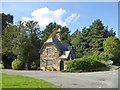

35 photos from this area
Area Information
Key information about the DE22 2EL including its size, population, and administrative classification.
- Area Type
- Postcode
- Area Size
- 1.4 hectares
- Population
- 1512
- Population Density
- 846 people/km²
House Prices in DE22 2EL
17
Properties
£468,091
Average Sold Price
£140,000
Lowest Price
£722,000
Highest Price
Showing 17 properties
| Address | Type | Beds | Baths | Last Sale Price | Last Sale Date | |
|---|---|---|---|---|---|---|
| 25 Evans Avenue, Derby, DE22 2EL | Detached | 6 | 2 | £720,000 | Sep 2023 | |
| 1 Evans Avenue, Derby, DE22 2EL | house | 4 | 2 | £625,000 | Sep 2022 | |
| 33 Evans Avenue, Derby, DE22 2EL | house | - | - | £722,000 | Aug 2022 | |
| 5 Evans Avenue, Derby, DE22 2EL | Detached | 4 | 3 | £570,000 | Feb 2021 | |
| 23 Evans Avenue, Derby, DE22 2EL | Detached | 6 | - | £609,000 | Sep 2019 | |
| 31 Evans Avenue, Derby, DE22 2EL | Detached | 4 | 2 | £475,000 | Jun 2019 | |
| 27 Evans Avenue, Derby, DE22 2EL | Semi-detached | - | - | £310,000 | Jan 2014 | |
| 7 Evans Avenue, Derby, DE22 2EL | Detached | - | - | £483,000 | Aug 2006 | |
| 29 Evans Avenue, Derby, DE22 2EL | Semi-detached | - | - | £320,000 | Jan 2005 | |
| 17 Evans Avenue, Derby, DE22 2EL | Detached | - | - | £175,000 | Dec 2000 |
Page 1 of 2
Energy Efficiency in DE22 2EL
Amenities
Schools
| Rank | School | Type | Entry gender | Ages |
|---|
Explore more schools in this area
Go to Schools tabDemographics
Household Size
Family (3-5 people)
most common
Accommodation Type
Houses
most common
Tenure
91
majority
Ethnic Group
White
most common
Religion
N/A
most common
Household Composition
N/A
most common
Age
47
median
Adults (30-64 years)
most common
Household Deprivation
N/A
with no deprivation
NS-SEC
51
in Lower managerial occupations
Explore more demographic insights in this area
Go to Demographics tabPlanning
Planning Constraints
- Flood RiskPremium
- Ramsar Wetland SitesPremium
- Area of Outstanding Natural BeautyPremium
- Protected Nature ReservePremium
- Protected WoodlandPremium