Area Overview for DE22 1GX
Photos of DE22 1GX
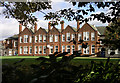
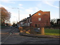
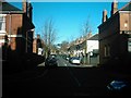
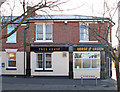
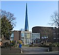
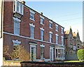
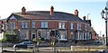
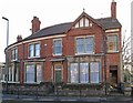
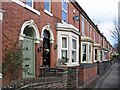
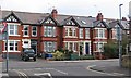
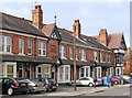
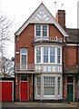
62 photos from this area
Area Information
Key information about the DE22 1GX including its size, population, and administrative classification.
- Area Type
- Postcode
- Area Size
- 1.3 hectares
- Population
- 1582
- Population Density
- 4991 people/km²
House Prices in DE22 1GX
18
Properties
£338,375
Average Sold Price
£85,000
Lowest Price
£650,000
Highest Price
Showing 18 properties
| Address | Type | Beds | Baths | Last Sale Price | Last Sale Date | |
|---|---|---|---|---|---|---|
| 21 Highfield Road, Derby, DE22 1GX | house | - | - | £540,000 | Oct 2023 | |
| 43 Highfield Road, Derby, DE22 1GX | house | - | - | £305,000 | Jan 2021 | |
| 31 Highfield Road, Derby, DE22 1GX | Detached | 3 | 2 | £296,000 | Aug 2020 | |
| 39 Highfield Road, Derby, DE22 1GX | Detached | 3 | - | £243,750 | Nov 2015 | |
| Provost House, 9 Highfield Road, Derby, DE22 1GX | house | - | - | £650,000 | Dec 2014 | |
| 5 Highfield Road, Derby, DE22 1GX | house | 3 | - | £499,000 | Jan 2014 | |
| 35 Highfield Road, Derby, DE22 1GX | Bungalow | - | - | £218,000 | Dec 2013 | |
| 27 Highfield Road, Derby, DE22 1GX | house | - | - | £322,000 | May 2013 | |
| 37 Highfield Road, Derby, DE22 1GX | Detached | - | - | £225,000 | Jun 2012 | |
| 67 Highfield Road, Derby, DE22 1GX | Detached | - | - | £85,000 | Aug 1995 |
Page 1 of 2
Energy Efficiency in DE22 1GX
Amenities
Schools
| Rank | School | Type | Entry gender | Ages |
|---|
Explore more schools in this area
Go to Schools tabDemographics
Household Size
One person
most common
Accommodation Type
Houses
most common
Tenure
63
majority
Ethnic Group
White
most common
Religion
N/A
most common
Household Composition
N/A
most common
Age
47
median
Adults (30-64 years)
most common
Household Deprivation
N/A
with no deprivation
NS-SEC
43
in Lower managerial occupations
Explore more demographic insights in this area
Go to Demographics tabPlanning
Planning Constraints
- Flood RiskPremium
- Ramsar Wetland SitesPremium
- Area of Outstanding Natural BeautyPremium
- Protected Nature ReservePremium
- Protected WoodlandPremium