Area Overview for DE22 1GJ
Photos of DE22 1GJ
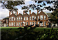
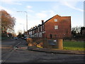
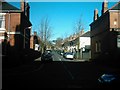
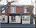
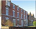
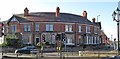
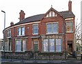
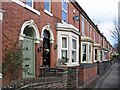
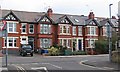
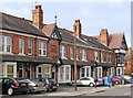
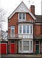
62 photos from this area
Area Information
Key information about the DE22 1GJ including its size, population, and administrative classification.
- Area Type
- Postcode
- Area Size
- 7575 m²
- Population
- 2247
- Population Density
- 3590 people/km²
House Prices in DE22 1GJ
42
Properties
£149,618
Average Sold Price
£38,000
Lowest Price
£350,000
Highest Price
Showing 42 properties
| Address | Type | Beds | Baths | Last Sale Price | Last Sale Date | |
|---|---|---|---|---|---|---|
| 63 Longford Street, Derby, DE22 1GJ | Terraced | 3 | 1 | £246,285 | Apr 2025 | |
| 33 Longford Street, Derby, DE22 1GJ | Terraced | 2 | 1 | £218,500 | Dec 2024 | |
| 49 Longford Street, Derby, DE22 1GJ | Terraced | 2 | 1 | £202,500 | May 2024 | |
| 25 Longford Street, Derby, DE22 1GJ | house | 1 | 1 | £212,000 | Apr 2023 | |
| 69 Longford Street, Derby, DE22 1GJ | Semi-detached | 3 | - | £160,000 | Apr 2023 | |
| 47 Longford Street, Derby, DE22 1GJ | Terraced | 2 | 1 | £180,000 | Dec 2022 | |
| 97 Longford Street, Derby, DE22 1GJ | Terraced | 3 | 1 | £197,950 | Jun 2022 | |
| 87 Longford Street, Derby, DE22 1GJ | Terraced | 3 | 1 | £172,500 | Jun 2021 | |
| 45 Longford Street, Derby, DE22 1GJ | house | - | - | £170,000 | Jun 2021 | |
| 57 Longford Street, Derby, DE22 1GJ | Terraced | 2 | 1 | £139,000 | Mar 2021 |
Page 1 of 5
Energy Efficiency in DE22 1GJ
Amenities
Schools
| Rank | School | Type | Entry gender | Ages |
|---|
Explore more schools in this area
Go to Schools tabDemographics
Household Size
One person
most common
Accommodation Type
Houses
most common
Tenure
53
majority
Ethnic Group
White
most common
Religion
N/A
most common
Household Composition
N/A
most common
Age
47
median
Adults (30-64 years)
most common
Household Deprivation
N/A
with no deprivation
NS-SEC
40
in Lower managerial occupations
Explore more demographic insights in this area
Go to Demographics tabPlanning
Planning Constraints
- Flood RiskPremium
- Ramsar Wetland SitesPremium
- Area of Outstanding Natural BeautyPremium
- Protected Nature ReservePremium
- Protected WoodlandPremium