Area Overview for DE22 1BH
Photos of DE22 1BH
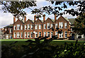
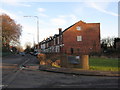
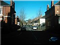
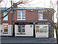
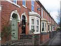
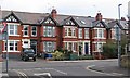
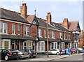
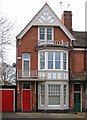
62 photos from this area
Area Information
Key information about the DE22 1BH including its size, population, and administrative classification.
- Area Type
- Postcode
- Area Size
- 8507 m²
- Population
- 1582
- Population Density
- 4991 people/km²
House Prices in DE22 1BH
9
Properties
£377,000
Average Sold Price
£115,000
Lowest Price
£645,000
Highest Price
Showing 9 properties
| Address | Type | Beds | Baths | Last Sale Price | Last Sale Date | |
|---|---|---|---|---|---|---|
| 176 Duffield Road, Derby, DE22 1BH | house | - | - | £575,000 | May 2024 | |
| 164 Duffield Road, Derby, DE22 1BH | Detached | 4 | 3 | £645,000 | Apr 2023 | |
| 166 Duffield Road, Derby, DE22 1BH | house | 3 | - | £285,000 | Aug 2010 | |
| 178 Duffield Road, Derby, DE22 1BH | house | - | - | £265,000 | Aug 2003 | |
| 174 Duffield Road, Derby, DE22 1BH | Semi-detached | - | - | £115,000 | May 1996 | |
| 162 Duffield Road, Derby, DE22 1BH | Detached | - | - | - | - | |
| 168 Duffield Road, Derby, DE22 1BH | Semi-detached | - | - | - | - | |
| 172 Duffield Road, Derby, DE22 1BH | Detached | - | - | - | - | |
| 170 Duffield Road, Derby, DE22 1BH | Detached | - | - | - | - |
Energy Efficiency in DE22 1BH
Amenities
Schools
| Rank | School | Type | Entry gender | Ages |
|---|
Explore more schools in this area
Go to Schools tabDemographics
Household Size
One person
most common
Accommodation Type
Houses
most common
Tenure
63
majority
Ethnic Group
White
most common
Religion
N/A
most common
Household Composition
N/A
most common
Age
47
median
Adults (30-64 years)
most common
Household Deprivation
N/A
with no deprivation
NS-SEC
43
in Lower managerial occupations
Explore more demographic insights in this area
Go to Demographics tabPlanning
Planning Constraints
- Flood RiskPremium
- Ramsar Wetland SitesPremium
- Area of Outstanding Natural BeautyPremium
- Protected Nature ReservePremium
- Protected WoodlandPremium