Area Overview for DE22 1BG
Photos of DE22 1BG
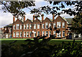
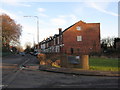
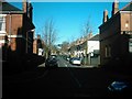
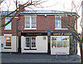
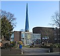
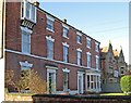
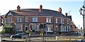
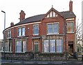
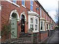
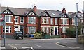
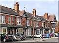
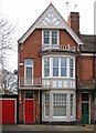
62 photos from this area
Area Information
Key information about the DE22 1BG including its size, population, and administrative classification.
- Area Type
- Postcode
- Area Size
- 1.0 hectares
- Population
- 1582
- Population Density
- 4991 people/km²
House Prices in DE22 1BG
47
Properties
£438,750
Average Sold Price
£245,000
Lowest Price
£650,000
Highest Price
Showing 47 properties
| Address | Type | Beds | Baths | Last Sale Price | Last Sale Date | |
|---|---|---|---|---|---|---|
| 130 Duffield Road, Derby, DE22 1BG | house | - | - | £650,000 | Mar 2023 | |
| FLAT 3, 110 DUFFIELD ROAD, Derby, DE22 1BG | Flat | - | - | £265,000 | May 2022 | |
| 118 Duffield Road, Derby, DE22 1BG | house | 4 | - | £335,000 | Mar 2022 | |
| 120 Duffield Road, Derby, DE22 1BG | house | - | - | £600,000 | Oct 2021 | |
| 140 Duffield Road, Derby, DE22 1BG | house | - | - | £627,500 | Sep 2021 | |
| 138 Duffield Road, Derby, DE22 1BG | house | 7 | 2 | £377,500 | Aug 2018 | |
| 128 Duffield Road, Derby, DE22 1BG | Detached | 5 | 2 | £410,000 | Jan 2014 | |
| 142 Duffield Road, Derby, DE22 1BG | house | - | - | £447,500 | Nov 2012 | |
| 132 Duffield Road, Derby, DE22 1BG | house | - | - | £430,000 | Aug 2011 | |
| 116 Duffield Road, Derby, DE22 1BG | house | 4 | - | £245,000 | Aug 2010 |
Page 1 of 5
Energy Efficiency in DE22 1BG
Amenities
Schools
| Rank | School | Type | Entry gender | Ages |
|---|
Explore more schools in this area
Go to Schools tabDemographics
Household Size
One person
most common
Accommodation Type
Houses
most common
Tenure
63
majority
Ethnic Group
White
most common
Religion
N/A
most common
Household Composition
N/A
most common
Age
47
median
Adults (30-64 years)
most common
Household Deprivation
N/A
with no deprivation
NS-SEC
43
in Lower managerial occupations
Explore more demographic insights in this area
Go to Demographics tabPlanning
Planning Constraints
- Flood RiskPremium
- Ramsar Wetland SitesPremium
- Area of Outstanding Natural BeautyPremium
- Protected Nature ReservePremium
- Protected WoodlandPremium