Area Overview for DE21 7UY
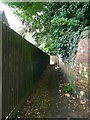
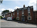
Photos of DE21 7UY


Area Information
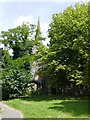
DE21 7UY lies in the eastern outskirts of Derby, within Spondon Ward, a historically distinct village now integrated into the city’s conurbation. This small postcode area spans 6 hectares, housing 2,451 residents in a compact residential cluster. The area’s roots trace back to the Domesday Book, where it was recorded as *Spondune*, and it retains traces of its medieval past, including St Werburgh’s Church. Today, it balances suburban tranquility with proximity to Derby’s urban amenities. With a population density of 548 people per square kilometre, the community feels close-knit yet manageable. Residents benefit from nearby retail hubs like Asda Derby and Sainsburys Chaddesden, while rail links to Derby and Spondon stations offer easy access to the city. The area’s compact size means daily life revolves around local shops, green spaces, and the historical character of Spondon, making it a practical choice for those seeking a blend of heritage and modern convenience.
- Area Type
- Postcode
- Area Size
- 6.0 hectares
- Population
- 2451
- Population Density
- 548 people/km²
DE21 7UY is a predominantly owner-occupied area, with 67% of homes owned by residents rather than rented. The accommodation type is exclusively houses, which is uncommon in many modern developments but reflects the area’s historical character as a village. This housing stock suggests a focus on family homes and long-term residency, with properties likely offering more space than apartments. The small size of the postcode area means the housing market is tightly concentrated, with limited scope for new developments. Buyers should consider that the area’s compact nature may limit availability, but the presence of houses could appeal to those seeking traditional, spacious living. Proximity to Derby’s urban amenities also makes it a practical choice for commuters or those wanting suburban comfort with city access.
House Prices in DE21 7UY
Showing 3 properties
| Address | Type | Beds | Baths | Last Sale Price | Last Sale Date | |
|---|---|---|---|---|---|---|
| Travelex, Travel Currency Exchange Booth, Asda, Derby Road, Spondon, Derby, DE21 7UY | Retail | - | - | - | - | |
| Asda Petrol Station, Asda Derby Superstore, Derby Road, Spondon, Derby, DE21 7UY | Retail | - | - | - | - | |
| Asda Pharmacy, Asda Derby Superstore, Derby Road, Spondon, Derby, DE21 7UY | shop | - | - | - | - |
Energy Efficiency in DE21 7UY
Living in DE21 7UY offers access to essential amenities within practical reach. Retail options include major supermarkets such as Asda Derby, Co-op Chaddesden, and Sainsburys Chaddesden, ensuring convenience for daily shopping. The area’s rail connections to Derby and Spondon stations provide easy access to the city’s cultural and commercial hubs. While specific parks or leisure facilities are not detailed in the data, the historical presence of Locko Park and St Werburgh’s Church suggests nearby green spaces and heritage sites. The compact nature of the area means residents can walk or cycle to shops and transport links, fostering a sense of community. The mix of retail, transport, and historical sites contributes to a lifestyle that balances practicality with local character.
Amenities
Schools
| Rank | School | Type | Entry gender | Ages |
|---|
Explore more schools in this area
Go to Schools tabDemographics
The population of DE21 7UY has a median age of 47, with the majority of residents aged 30–64. This suggests a community skewed toward middle-aged adults, likely including professionals, families, and retirees. Home ownership rates stand at 67%, indicating a stable, long-term resident base. The area is predominantly composed of houses, reflecting a traditional suburban layout. The predominant ethnic group is White, though specific diversity metrics are not provided. The age profile and ownership figures suggest a mature, established neighbourhood with limited turnover. The absence of data on deprivation means it is difficult to assess socioeconomic challenges, but the high home ownership and age distribution imply a relatively stable quality of life.
Household Size
Accommodation Type
Tenure
Ethnic Group
Religion
Household Composition
Age
Household Deprivation
NS-SEC
Explore more demographic insights in this area
Go to Demographics tabPlanning
Planning Constraints
- Flood RiskPremium
- Ramsar Wetland SitesPremium
- Area of Outstanding Natural BeautyPremium
- Protected Nature ReservePremium
- Protected WoodlandPremium