Area Overview for DE21 6XT
Photos of DE21 6XT
Area Information
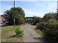
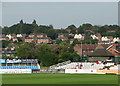
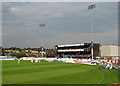
Living in DE21 6XT means being part of a small, tightly knit residential cluster in Derby, a city in the East Midlands. This postcode area, with a population of 1,545, sits approximately 2.5 miles east of Derby’s city centre, blending historical roots with modern convenience. Historically known as Chaddesden, the area was incorporated into Derby through boundary extensions in the early 20th century. Today, it retains traces of its past, such as Chaddesden Park—a 60-acre public space once part of a noble estate—while offering proximity to Derby’s amenities. The area’s compact size and low population density create a quieter, more residential feel compared to central Derby. With a median age of 47, the community is predominantly composed of adults aged 30–64, reflecting a mature, stable demographic. While the area lacks the density of urban hubs, its strategic location near rail networks and retail hubs like Sainsburys Derby ensures practical connectivity for daily life.
- Area Type
- Postcode
- Area Size
- Not available
- Population
- 1545
- Population Density
- 1683 people/km²
The property market in DE21 6XT is shaped by its low home ownership rate of 30%, which implies that the majority of housing stock is rented out. This contrasts with many urban areas where owner-occupation is more common, suggesting a rental-focused market. The accommodation type is primarily houses, which is atypical for a postcode area of this size but may reflect the historical development of the region, including former estates like the Wood Road Estate. For buyers, this means limited availability of owner-occupied properties and a focus on semi-detached or detached homes. The small size of the area also means that property choices are constrained, with proximity to Derby’s city centre offering more options for those willing to commute. Potential buyers should consider the area’s lower home ownership rate when assessing long-term investment potential.
House Prices in DE21 6XT
No properties found in this postcode.
Energy Efficiency in DE21 6XT
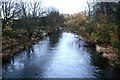
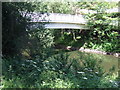
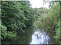
Daily life in DE21 6XT is shaped by its proximity to retail and leisure hubs. Within practical reach are notable venues such as Sainsburys Derby, Iceland Albion, and M&S Derby, offering a range of shopping and dining options. The area’s historical character is complemented by Chaddesden Park, a 60-acre public space that provides green space for recreation. The park, once part of a noble estate, includes a paddling pool and open areas for walks or relaxation. While the data does not list specific restaurants or cafés, the presence of major retailers and rail links suggests a balance between convenience and quiet living. The combination of retail access, green space, and transport options makes DE21 6XT appealing to those seeking a mix of practicality and low-key urban living.
Amenities
Schools
Residents of DE21 6XT have access to two primary schools: Derwent Community School and Derwent Primary School, both of which serve the local area. Derwent Primary School holds an Ofsted rating of ‘good’, indicating a satisfactory standard of education. While no secondary schools are listed in the data, the presence of two primary schools suggests a focus on early education for families with young children. The mix of primary schools may cater to different educational preferences, though the absence of secondary options could influence decisions for households planning for long-term schooling. For parents, the proximity of these schools to homes in DE21 6XT is a practical advantage, reducing the need for long commutes.
| Rank | School | Type | Entry gender | Ages |
|---|
Explore more schools in this area
Go to Schools tabDemographics
DE21 6XT’s population of 1,545 is characterised by a median age of 47, with the majority of residents falling into the 30–64 age bracket. This suggests a community of established professionals and families, likely with longer-term ties to the area. Home ownership is relatively low at 30%, indicating a higher proportion of renters, which may reflect the area’s appeal to those seeking flexibility in housing. The predominant accommodation type is houses, which is unusual for urban areas but aligns with the residential character of Chaddesden. The predominant ethnic group is White, with no specific data on other demographics provided. The age profile and ownership figures suggest a stable, middle-aged population with limited turnover, though the absence of data on deprivation or income levels means the area’s economic diversity remains unclear.
Household Size
Accommodation Type
Tenure
Ethnic Group
Religion
Household Composition
Age
Household Deprivation
NS-SEC
Explore more demographic insights in this area
Go to Demographics tabPlanning
Planning Constraints
- Flood RiskPremium
- Ramsar Wetland SitesPremium
- Area of Outstanding Natural BeautyPremium
- Protected Nature ReservePremium
- Protected WoodlandPremium