Area Overview for DE21 6XF
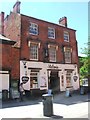
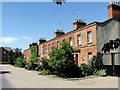
Photos of DE21 6XF


Area Information
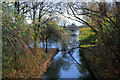
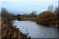
Living in DE21 6XF means being part of a small, tightly knit residential cluster in Derby, a city in the East Midlands. With a population of just 1,286, the area is compact but offers access to Derby’s broader amenities. The postcode is closely linked to Derby Arboretum, a historic park established in 1840 as England’s first public urban recreational space. This green space, just a mile from Derby city centre, anchors daily life here, offering walking routes, open spaces, and a legacy of public investment. The area’s character is shaped by its proximity to this landmark, which remains a focal point for leisure and community activity. Residents benefit from a mix of practical infrastructure, including nearby rail stations and retail hubs, while the low population density suggests a quieter, more manageable pace of life. For those seeking a balance between urban convenience and greenery, DE21 6XF provides a distinct microcosm of Derby’s heritage and modernity.
- Area Type
- Postcode
- Area Size
- Not available
- Population
- 1286
- Population Density
- 2419 people/km²
The property market in DE21 6XF is characterised by a low home ownership rate of 29%, suggesting that the area functions more as a rental market than an owner-occupied one. The predominant accommodation type is flats, which implies a mix of purpose-built housing and conversions. This configuration is typical in smaller urban clusters where space is limited, and housing is designed for efficiency rather than family expansion. For buyers, this means the area may not be ideal for those seeking long-term ownership or larger properties. The small population and limited housing stock also mean that the immediate surroundings are critical for property availability. Those considering DE21 6XF should assess whether the rental market aligns with their goals, as the low ownership rate may indicate limited opportunities for investment or equity growth.
House Prices in DE21 6XF
No properties found in this postcode.
Energy Efficiency in DE21 6XF
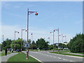
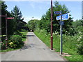
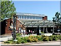
Daily life in DE21 6XF is enriched by nearby amenities that cater to practical needs and leisure. The area’s proximity to Derby’s rail network, including Derby Railway Station and Spondon, ensures easy access to the city’s cultural and commercial hubs. Retail options like Tesco Derby, M&S, and Sainsburys provide essential shopping, while the historic Derby Arboretum offers a green space for recreation. This park, a Grade II* listed site, is central to the area’s identity, offering walking paths, open lawns, and historical features. The mix of retail, transport, and natural spaces creates a lifestyle that balances urban convenience with accessible nature. For residents, the area’s small scale means amenities are within walking or short driving distance, fostering a sense of ease in managing daily routines.
Amenities
Schools
Residents of DE21 6XF have access to a range of educational institutions, including Castle Nursery School, a nursery with no Ofsted rating listed, and St James’ Church of England Aided Infant School, a primary school rated ‘good’ by Ofsted. The area also includes Castleward Spencer Academy, an academy rated ‘outstanding’. This mix of nursery, primary, and academy schools provides options for families at different stages of education. The presence of an outstanding-rated academy suggests high academic standards, while the good-rated primary school offers a reliable foundation for younger children. The nursery covers early years education, ensuring continuity for families moving through the education system. These schools collectively support a community focused on education, though specific data on school catchment areas or pupil numbers is not provided.
| Rank | School | Type | Entry gender | Ages |
|---|
Explore more schools in this area
Go to Schools tabDemographics
The community in DE21 6XF is predominantly middle-aged, with a median age of 47 and the majority of residents falling within the 30-64 age range. Home ownership is relatively low at 29%, indicating a rental-dominated housing market. The accommodation type is largely flats, reflecting a mix of purpose-built and converted properties. The predominant ethnic group is White, though specific data on diversity beyond this is not provided. The age profile suggests a stable, established population with fewer young families, which may influence local services and amenities. The low home ownership rate could indicate a transient demographic or a focus on rental properties, potentially affecting community cohesion. For prospective buyers, this data highlights a market where ownership is less common, and the housing stock is tailored to renters rather than long-term homeowners.
Household Size
Accommodation Type
Tenure
Ethnic Group
Religion
Household Composition
Age
Household Deprivation
NS-SEC
Explore more demographic insights in this area
Go to Demographics tabPlanning
Planning Constraints
- Flood RiskPremium
- Ramsar Wetland SitesPremium
- Area of Outstanding Natural BeautyPremium
- Protected Nature ReservePremium
- Protected WoodlandPremium