Area Overview for DE21 6SG
Photos of DE21 6SG
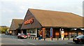

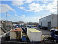
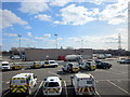
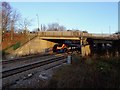

29 photos from this area
Area Information
Key information about the DE21 6SG including its size, population, and administrative classification.
- Area Type
- Postcode
- Area Size
- 1.7 hectares
- Population
- 1436
- Population Density
- 1731 people/km²
House Prices in DE21 6SG
44
Properties
£120,160
Average Sold Price
£25,000
Lowest Price
£235,000
Highest Price
Showing 44 properties
| Address | Type | Beds | Baths | Last Sale Price | Last Sale Date | |
|---|---|---|---|---|---|---|
| 101 Albert Road, Derby, DE21 6SG | Semi-detached | 3 | 1 | £155,000 | Jul 2025 | |
| 112 Albert Road, Derby, DE21 6SG | Semi-detached | 3 | 1 | £185,000 | Aug 2023 | |
| 110 Albert Road, Derby, DE21 6SG | Semi-detached | 3 | 1 | £180,000 | Feb 2023 | |
| 108 Albert Road, Derby, DE21 6SG | house | - | - | £235,000 | Feb 2023 | |
| 125 Albert Road, Derby, DE21 6SG | house | - | - | £175,000 | Sep 2021 | |
| 114 Albert Road, Derby, DE21 6SG | Semi-detached | 3 | 1 | £135,000 | Aug 2020 | |
| 95 Albert Road, Derby, DE21 6SG | house | - | - | £160,000 | Sep 2019 | |
| 81 Albert Road, Derby, DE21 6SG | house | - | - | £152,950 | Aug 2019 | |
| 86 Albert Road, Derby, DE21 6SG | Semi-detached | 3 | - | £145,000 | Feb 2019 | |
| 96 Albert Road, Derby, DE21 6SG | Semi-detached | 3 | - | £174,000 | Feb 2019 |
Page 1 of 5
Energy Efficiency in DE21 6SG
Amenities
Schools
| Rank | School | Type | Entry gender | Ages |
|---|
Explore more schools in this area
Go to Schools tabDemographics
Household Size
Two person
most common
Accommodation Type
Houses
most common
Tenure
49
majority
Ethnic Group
White
most common
Religion
N/A
most common
Household Composition
N/A
most common
Age
47
median
Adults (30-64 years)
most common
Household Deprivation
N/A
with no deprivation
NS-SEC
19
in Lower managerial occupations
Explore more demographic insights in this area
Go to Demographics tabPlanning
Planning Constraints
- Flood RiskPremium
- Ramsar Wetland SitesPremium
- Area of Outstanding Natural BeautyPremium
- Protected Nature ReservePremium
- Protected WoodlandPremium