Area Overview for DE21 6EG
Photos of DE21 6EG

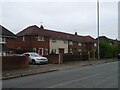
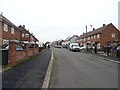
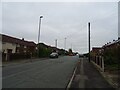
17 photos from this area
Area Information
Key information about the DE21 6EG including its size, population, and administrative classification.
- Area Type
- Postcode
- Area Size
- 1.7 hectares
- Population
- 1732
- Population Density
- 9006 people/km²
House Prices in DE21 6EG
44
Properties
£104,091
Average Sold Price
£48,000
Lowest Price
£159,000
Highest Price
Showing 44 properties
| Address | Type | Beds | Baths | Last Sale Price | Last Sale Date | |
|---|---|---|---|---|---|---|
| 153 Cowsley Road, Derby, DE21 6EG | house | - | - | £159,000 | Dec 2025 | |
| 170 Cowsley Road, Derby, DE21 6EG | Semi-detached | 2 | 1 | £130,000 | Mar 2023 | |
| 156 Cowsley Road, Derby, DE21 6EG | Detached | 2 | 1 | £136,000 | Sep 2022 | |
| 155 Cowsley Road, Derby, DE21 6EG | Semi-detached | 3 | 1 | £146,000 | Sep 2021 | |
| 166 Cowsley Road, Derby, DE21 6EG | house | - | - | £99,000 | Sep 2020 | |
| 175 Cowsley Road, Derby, DE21 6EG | Semi-detached | 3 | 1 | £125,000 | Dec 2019 | |
| 150 Cowsley Road, Derby, DE21 6EG | Semi-detached | 3 | 1 | £95,000 | Oct 2018 | |
| 160 Cowsley Road, Derby, DE21 6EG | Semi-detached | 3 | 1 | £66,000 | Jan 2013 | |
| 158 Cowsley Road, Derby, DE21 6EG | Semi-detached | 2 | 1 | £69,000 | Jul 2006 | |
| 164 Cowsley Road, Derby, DE21 6EG | Semi-detached | - | - | £72,000 | Aug 2005 |
Page 1 of 5
Energy Efficiency in DE21 6EG
Amenities
Schools
| Rank | School | Type | Entry gender | Ages |
|---|
Explore more schools in this area
Go to Schools tabDemographics
Household Size
Family (3-5 people)
most common
Accommodation Type
Houses
most common
Tenure
29
majority
Ethnic Group
White
most common
Religion
N/A
most common
Household Composition
N/A
most common
Age
22
median
Adults (30-64 years)
most common
Household Deprivation
N/A
with no deprivation
NS-SEC
12
in Lower managerial occupations
Explore more demographic insights in this area
Go to Demographics tabPlanning
Planning Constraints
- Flood RiskPremium
- Ramsar Wetland SitesPremium
- Area of Outstanding Natural BeautyPremium
- Protected Nature ReservePremium
- Protected WoodlandPremium