Area Overview for DE21 4FP
Photos of DE21 4FP
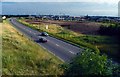
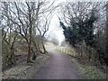
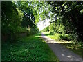
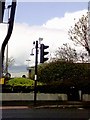
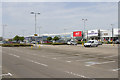
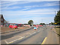
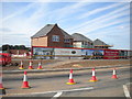
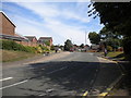
26 photos from this area
Area Information
Key information about the DE21 4FP including its size, population, and administrative classification.
- Area Type
- Postcode
- Area Size
- 7483 m²
- Population
- 1509
- Population Density
- 3698 people/km²
House Prices in DE21 4FP
28
Properties
£104,717
Average Sold Price
£33,000
Lowest Price
£175,000
Highest Price
Showing 28 properties
| Address | Type | Beds | Baths | Last Sale Price | Last Sale Date | |
|---|---|---|---|---|---|---|
| 106 Perth Street, Derby, DE21 4FP | Semi-detached | 3 | 1 | £175,000 | Aug 2023 | |
| 122 Perth Street, Derby, DE21 4FP | house | - | - | £160,000 | Jan 2023 | |
| 130 Perth Street, Derby, DE21 4FP | Semi-detached | 3 | 1 | £97,500 | Feb 2018 | |
| 110 Perth Street, Derby, DE21 4FP | house | - | - | £119,000 | Feb 2018 | |
| 128 Perth Street, Derby, DE21 4FP | house | - | - | £121,000 | Oct 2017 | |
| 132 Perth Street, Derby, DE21 4FP | Semi-detached | 3 | - | £107,000 | Oct 2014 | |
| 86 Perth Street, Derby, DE21 4FP | Semi-detached | - | - | £90,000 | Aug 2004 | |
| 94 Perth Street, Derby, DE21 4FP | Semi-detached | - | - | £39,950 | Jan 2001 | |
| 134 Perth Street, Derby, DE21 4FP | Semi-detached | - | - | £33,000 | Sep 1995 | |
| 136 Perth Street, Derby, DE21 4FP | Semi-detached | - | - | - | - |
Page 1 of 3
Energy Efficiency in DE21 4FP
Amenities
Schools
| Rank | School | Type | Entry gender | Ages |
|---|
Explore more schools in this area
Go to Schools tabDemographics
Household Size
Family (3-5 people)
most common
Accommodation Type
Houses
most common
Tenure
66
majority
Ethnic Group
White
most common
Religion
N/A
most common
Household Composition
N/A
most common
Age
47
median
Adults (30-64 years)
most common
Household Deprivation
N/A
with no deprivation
NS-SEC
19
in Lower managerial occupations
Explore more demographic insights in this area
Go to Demographics tabPlanning
Planning Constraints
- Flood RiskPremium
- Ramsar Wetland SitesPremium
- Area of Outstanding Natural BeautyPremium
- Protected Nature ReservePremium
- Protected WoodlandPremium