Area Overview for DE21 2TQ
Photos of DE21 2TQ
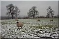
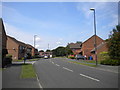
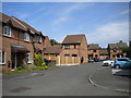
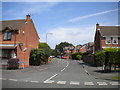
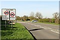
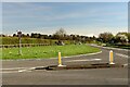
19 photos from this area
Area Information
Key information about the DE21 2TQ including its size, population, and administrative classification.
- Area Type
- Postcode
- Area Size
- 1.1 hectares
- Population
- 1478
- Population Density
- 3771 people/km²
House Prices in DE21 2TQ
26
Properties
£238,666
Average Sold Price
£89,250
Lowest Price
£475,000
Highest Price
Showing 26 properties
| Address | Type | Beds | Baths | Last Sale Price | Last Sale Date | |
|---|---|---|---|---|---|---|
| 9 Kershope Drive, Derby, DE21 2TQ | Detached | 4 | 2 | £390,000 | Aug 2025 | |
| 15 Kershope Drive, Derby, DE21 2TQ | Detached | 4 | 2 | £380,000 | Oct 2023 | |
| 1 Kershope Drive, Derby, DE21 2TQ | house | - | - | £363,500 | Jul 2023 | |
| 20 Kershope Drive, Derby, DE21 2TQ | Detached | 3 | 1 | £280,000 | Jun 2023 | |
| 24 Kershope Drive, Derby, DE21 2TQ | house | - | - | £475,000 | Dec 2022 | |
| 16 Kershope Drive, Derby, DE21 2TQ | Detached | 4 | 2 | £285,000 | Feb 2018 | |
| 32 Kershope Drive, Derby, DE21 2TQ | house | - | - | £270,000 | Jan 2017 | |
| 22 Kershope Drive, Derby, DE21 2TQ | Detached | 3 | - | £199,950 | Jul 2014 | |
| 28 Kershope Drive, Derby, DE21 2TQ | Detached | 4 | 2 | £225,000 | Feb 2013 | |
| 14 Kershope Drive, Derby, DE21 2TQ | house | - | - | £279,000 | Jun 2010 |
Page 1 of 3
Energy Efficiency in DE21 2TQ
Amenities
Schools
| Rank | School | Type | Entry gender | Ages |
|---|
Explore more schools in this area
Go to Schools tabDemographics
Household Size
Family (3-5 people)
most common
Accommodation Type
Houses
most common
Tenure
86
majority
Ethnic Group
White
most common
Religion
N/A
most common
Household Composition
N/A
most common
Age
47
median
Adults (30-64 years)
most common
Household Deprivation
N/A
with no deprivation
NS-SEC
47
in Lower managerial occupations
Explore more demographic insights in this area
Go to Demographics tabPlanning
Planning Constraints
- Flood RiskPremium
- Ramsar Wetland SitesPremium
- Area of Outstanding Natural BeautyPremium
- Protected Nature ReservePremium
- Protected WoodlandPremium