Area Overview for DE21 2TG
Photos of DE21 2TG
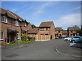
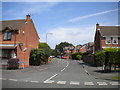
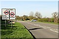
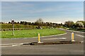
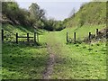
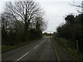
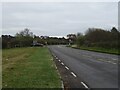
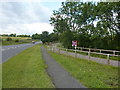
19 photos from this area
Area Information
Key information about the DE21 2TG including its size, population, and administrative classification.
- Area Type
- Postcode
- Area Size
- 4445 m²
- Population
- 1318
- Population Density
- 4756 people/km²
House Prices in DE21 2TG
20
Properties
£128,194
Average Sold Price
£59,500
Lowest Price
£192,000
Highest Price
Showing 20 properties
| Address | Type | Beds | Baths | Last Sale Price | Last Sale Date | |
|---|---|---|---|---|---|---|
| 15 Hucklow Court, Derby, DE21 2TG | Semi-detached | 2 | 1 | £192,000 | Sep 2024 | |
| 26 Hucklow Court, Derby, DE21 2TG | Semi-detached | 2 | 1 | £190,000 | Jun 2023 | |
| 24 Hucklow Court, Derby, DE21 2TG | house | - | - | £190,000 | Nov 2022 | |
| 3 Hucklow Court, Derby, DE21 2TG | house | - | - | £189,500 | Jan 2022 | |
| 10 Hucklow Court, Derby, DE21 2TG | house | - | - | £162,000 | Jan 2022 | |
| 14 Hucklow Court, Derby, DE21 2TG | house | 2 | 1 | £129,950 | Mar 2016 | |
| 9 Hucklow Court, Derby, DE21 2TG | Terraced | - | - | £143,950 | Sep 2015 | |
| 22 Hucklow Court, Derby, DE21 2TG | Semi-detached | 2 | 1 | £135,000 | Jan 2015 | |
| 16 Hucklow Court, Derby, DE21 2TG | Terraced | 2 | 1 | £109,000 | Jun 2013 | |
| 20 Hucklow Court, Derby, DE21 2TG | Semi-detached | 2 | 1 | £121,000 | Feb 2012 |
Page 1 of 2
Energy Efficiency in DE21 2TG
Amenities
Schools
| Rank | School | Type | Entry gender | Ages |
|---|
Explore more schools in this area
Go to Schools tabDemographics
Household Size
Two person
most common
Accommodation Type
Houses
most common
Tenure
83
majority
Ethnic Group
White
most common
Religion
N/A
most common
Household Composition
N/A
most common
Age
47
median
Adults (30-64 years)
most common
Household Deprivation
N/A
with no deprivation
NS-SEC
46
in Lower managerial occupations
Explore more demographic insights in this area
Go to Demographics tabPlanning
Planning Constraints
- Flood RiskPremium
- Ramsar Wetland SitesPremium
- Area of Outstanding Natural BeautyPremium
- Protected Nature ReservePremium
- Protected WoodlandPremium