Area Overview for DE2 7UX
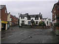
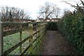
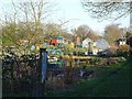
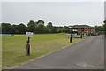
Photos of DE2 7UX
Area Information
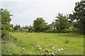
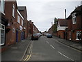
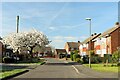
DE2 7UX is a small residential postcode area on Derby’s eastern outskirts, historically part of the village of Spondon. With a population of 1,394, it is a compact, suburban enclave integrated into the wider Derby conurbation. The area’s roots trace back to the Domesday Book, where it was recorded as *Spondune*, meaning a hill where wood-chips were gathered. Today, it blends traditional charm with modern convenience, offering a quiet alternative to Derby’s urban core. Residents benefit from proximity to rail networks, including Spondon and Derby stations, and nearby tram stops. The area’s character is defined by its mix of historic features, such as St Werburgh’s Church, and practical amenities like Co-op Spondon and Asda Derby. Families are well-served by local primary schools, while the low crime score of 67 and minimal flood risk make it an appealing choice for those prioritising safety. Though small, DE2 7UX provides a self-contained lifestyle with easy access to Derby’s cultural and economic hubs.
- Area Type
- Postcode
- Area Size
- Not available
- Population
- 1394
- Population Density
- 4511 people/km²
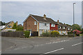
DE2 7UX is a largely owner-occupied area, with 79% of properties in private hands. The housing stock is dominated by houses, reflecting its suburban character and appeal to families seeking space and stability. This contrasts with areas where rental properties or flats predominate, making DE2 7UX a niche market for buyers seeking long-term residency. The small size of the postcode area means that the property market is tightly knit, with limited stock and potentially competitive conditions for buyers. The focus on houses suggests that the area is less suited to investors seeking high turnover, but more aligned with those prioritising family homes. Proximity to Derby’s rail network and amenities like Co-op Spondon adds to its desirability, though the compact nature of the area means that buyers should consider nearby suburbs for broader options.
House Prices in DE2 7UX
No properties found in this postcode.
Energy Efficiency in DE2 7UX
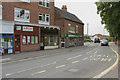
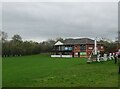
Living in DE2 7UX offers a balance of convenience and suburban tranquillity. The area’s retail landscape includes five notable venues, such as Co-op Spondon, Asda Derby, and Co-op Chaddesden, providing everyday shopping needs within easy reach. Residents can access rail stations like Spondon and Derby, as well as tram stops at Tram Park & Ride, facilitating travel to Derby’s cultural and commercial centres. The presence of St Werburgh’s Church and historical sites like Locko Park adds a layer of heritage to daily life. While the data does not specify parks or leisure facilities, the proximity to Derby’s amenities suggests a range of recreational options. The area’s mix of retail, transport, and historic features creates a lifestyle that is both practical and rooted in local tradition, appealing to those who value accessibility without sacrificing a sense of community.
Amenities
Schools
The area is served by two primary schools: Borrow Wood Infant School and Borrow Wood Primary School, the latter of which holds a ‘good’ Ofsted rating. Both institutions cater to younger children, providing a foundation for education within the community. The presence of two primary schools in close proximity reduces the need for long commutes for families with young children, though secondary education options are not listed in the data. This suggests that parents may need to look beyond DE2 7UX for secondary schooling. The schools’ availability and quality contribute to the area’s appeal for families, offering a practical solution for early education. However, the absence of specific data on school catchment areas or performance metrics beyond the Ofsted rating means that further research would be necessary for a comprehensive understanding of educational provision.
| Rank | School | Type | Entry gender | Ages |
|---|
Explore more schools in this area
Go to Schools tabDemographics
The population of DE2 7UX is predominantly adults aged 30–64, with a median age of 47. This suggests a community of established professionals and families, reflecting a stable demographic profile. Home ownership is high at 79%, indicating a strong presence of long-term residents and a focus on property as an investment. The area is characterised by houses rather than flats, aligning with its suburban nature. The predominant ethnic group is White, though no further breakdown of diversity is provided. The absence of specific data on deprivation or other socioeconomic factors means that quality of life can be inferred from the low crime score and robust infrastructure. The age range and home ownership figures suggest a mature, settled population with a focus on family-oriented living, supported by local amenities and transport links.
Household Size
Accommodation Type
Tenure
Ethnic Group
Religion
Household Composition
Age
Household Deprivation
NS-SEC
Explore more demographic insights in this area
Go to Demographics tabPlanning
Planning Constraints
- Flood RiskPremium
- Ramsar Wetland SitesPremium
- Area of Outstanding Natural BeautyPremium
- Protected Nature ReservePremium
- Protected WoodlandPremium