Area Overview for DE12 8BH
Photos of DE12 8BH
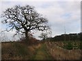
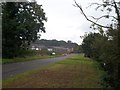
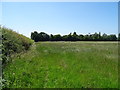
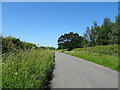
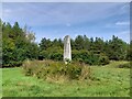
9 photos from this area
Area Information
Key information about the DE12 8BH including its size, population, and administrative classification.
- Area Type
- Postcode
- Area Size
- 79.0 hectares
- Population
- 1642
- Population Density
- 87 people/km²
House Prices in DE12 8BH
14
Properties
£1,500,000
Average Sold Price
£1,500,000
Lowest Price
£1,500,000
Highest Price
Showing 14 properties
| Address | Type | Beds | Baths | Last Sale Price | Last Sale Date | |
|---|---|---|---|---|---|---|
| Grange Cottage, Grangewood, Netherseal, Swadlincote, DE12 8BH | Detached | 6 | 3 | £1,500,000 | Jun 2023 | |
| Cabin, Seal Brook Farm, Grangewood Off Lullington Road, Swadlincote, DE12 8BH | Bungalow | 1 | 4 | - | - | |
| Flat, Grangewood Lodge, Grangewood, Netherseal, Swadlincote, DE12 8BH | Flat | - | - | - | - | |
| Cedar Lodge, Grangewood, Netherseal, Swadlincote, DE12 8BH | Detached | - | - | - | - | |
| Sealbrook Farm, Grangewood Off Lullington Road, Swadlincote, DE12 8BH | hotel | - | - | - | - | |
| Willow Cottage, Grangewood, Netherseal, Swadlincote, DE12 8BH | Detached | - | - | - | - | |
| Grangewood Lodge Residential Home, Grangewood, Netherseal, Swadlincote, DE12 8BH | Retirement | - | - | - | - | |
| 2, Woodfields Farm Cottage, Grangewood, Netherseal, Swadlincote, DE12 8BH | Semi-detached | - | - | - | - | |
| Woodlands View, Grangewood, Netherseal, Swadlincote, DE12 8BH | Detached | - | - | - | - | |
| Woodfield Farm, Grangewood, Netherseal, Swadlincote, DE12 8BH | house | - | - | - | - |
Page 1 of 2
Energy Efficiency in DE12 8BH
Amenities
Schools
| Rank | School | Type | Entry gender | Ages |
|---|
Explore more schools in this area
Go to Schools tabDemographics
Household Size
Two person
most common
Accommodation Type
Houses
most common
Tenure
67
majority
Ethnic Group
White
most common
Religion
N/A
most common
Household Composition
N/A
most common
Age
47
median
Adults (30-64 years)
most common
Household Deprivation
N/A
with no deprivation
NS-SEC
30
in Lower managerial occupations
Explore more demographic insights in this area
Go to Demographics tabPlanning
Planning Constraints
- Flood RiskPremium
- Ramsar Wetland SitesPremium
- Area of Outstanding Natural BeautyPremium
- Protected Nature ReservePremium
- Protected WoodlandPremium