Area Overview for DE12 7PY
Photos of DE12 7PY
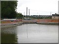
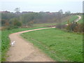
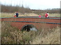
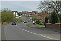
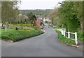
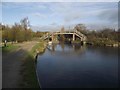
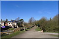
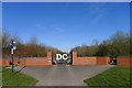
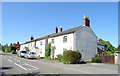
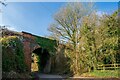
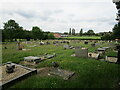
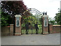
68 photos from this area
Area Information
Key information about the DE12 7PY including its size, population, and administrative classification.
- Area Type
- Postcode
- Area Size
- 6.6 hectares
- Population
- 1362
- Population Density
- 484 people/km²
House Prices in DE12 7PY
22
Properties
£170,021
Average Sold Price
£20,000
Lowest Price
£426,000
Highest Price
Showing 22 properties
| Address | Type | Beds | Baths | Last Sale Price | Last Sale Date | |
|---|---|---|---|---|---|---|
| 46A Church Street, Donisthorpe, DE12 7PY | Bungalow | 3 | 2 | £426,000 | Apr 2025 | |
| 36 Church Street, Donisthorpe, DE12 7PY | Semi-detached | 4 | 3 | £300,000 | Apr 2018 | |
| The Old Church Hall, Church Street, Donisthorpe, DE12 7PY | house | - | - | £270,000 | Jul 2017 | |
| 34 Church Street, Donisthorpe, DE12 7PY | house | 2 | - | £122,000 | May 2016 | |
| 50 Church Street, Donisthorpe, DE12 7PY | Detached | 4 | 3 | £190,000 | Nov 2014 | |
| 48 Church Street, Donisthorpe, DE12 7PY | house | 3 | - | £232,500 | Dec 2012 | |
| 42 Church Street, Donisthorpe, DE12 7PY | house | - | - | £125,000 | Apr 2010 | |
| 2 Church Street, Donisthorpe, DE12 7PY | Semi-detached | 4 | 1 | £175,000 | Oct 2007 | |
| 32 Church Street, Donisthorpe, DE12 7PY | Terraced | - | - | £59,000 | Apr 2002 | |
| 4 Church Street, Donisthorpe, DE12 7PY | house | - | - | £73,750 | Jul 2001 |
Page 1 of 3
Energy Efficiency in DE12 7PY
Amenities
Schools
| Rank | School | Type | Entry gender | Ages |
|---|
Explore more schools in this area
Go to Schools tabDemographics
Household Size
Two person
most common
Accommodation Type
Houses
most common
Tenure
75
majority
Ethnic Group
White
most common
Religion
N/A
most common
Household Composition
N/A
most common
Age
47
median
Adults (30-64 years)
most common
Household Deprivation
N/A
with no deprivation
NS-SEC
30
in Lower managerial occupations
Explore more demographic insights in this area
Go to Demographics tabPlanning
Planning Constraints
- Flood RiskPremium
- Ramsar Wetland SitesPremium
- Area of Outstanding Natural BeautyPremium
- Protected Nature ReservePremium
- Protected WoodlandPremium