Area Overview for DE11 8LP
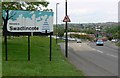
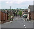
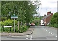
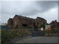
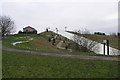
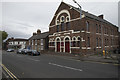
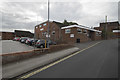
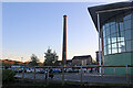
Photos of DE11 8LP


Area Information
Living in DE11 8LP offers a compact, residential experience shaped by its small footprint of 4.3 hectares and a population of 2037 people. The area is a tightly knit cluster, with a population density of 1726 people per square kilometre, suggesting a mix of established homes and community interaction. Daily life here is likely characterised by proximity to local amenities and a focus on nearby services. The presence of two primary schools, St George’s CofE Controlled Primary School and St George’s CofE Primary School, indicates a family-friendly orientation. Residents benefit from nearby rail links, with Burton and Willington Railway Stations providing connections to surrounding towns. While the area is small, it balances residential tranquillity with practical access to shopping, including Aldi Castle, Iceland Swadlincote, and Morrisons Castle. The median age of 47 suggests a community of adults, many of whom may be settled in long-term homes. For buyers, DE11 8LP presents a niche opportunity in a specific postcode, ideal for those prioritising convenience and proximity to essential services.
- Area Type
- Postcode
- Area Size
- 4.3 hectares
- Population
- 2037
- Population Density
- 1726 people/km²
The property market in DE11 8LP is dominated by owner-occupied homes, with 67% of residents owning their properties. This contrasts with areas where rental demand drives the market, indicating a focus on private, long-term investment. The accommodation type is primarily houses, which aligns with the area’s small, residential nature. Given the postcode’s limited size of 4.3 hectares, the housing stock is likely constrained, making it a niche market for buyers seeking specific locations. The high home ownership rate suggests limited turnover, which could mean fewer opportunities for new buyers but also stable property values. Proximity to schools and rail links may enhance desirability, though the area’s compact size means buyers should consider nearby extensions for additional options.
House Prices in DE11 8LP
Showing 1 properties
| Address | Type | Beds | Baths | Last Sale Price | Last Sale Date | |
|---|---|---|---|---|---|---|
| Woodhouse Sports Pavilion, Woodhouse Street, Woodville, Swadlincote, DE11 8LP | Leisure | - | - | - | - |
Energy Efficiency in DE11 8LP
Residents of DE11 8LP have access to a range of nearby amenities, including five retail outlets such as Aldi Castle, Iceland Swadlincote, and Morrisons Castle. These shops provide essential grocery and household services, reducing the need for long trips. The two railway stations, Burton and Willington, offer transport links to surrounding areas, enhancing accessibility for leisure or commuting. While the area is small, the proximity of these amenities suggests a focus on convenience. The lack of detailed information on parks or leisure facilities means the full extent of recreational options is unclear. Nonetheless, the availability of retail and rail services contributes to a practical, everyday lifestyle, supporting both daily needs and occasional travel.
Amenities
Schools
Residents of DE11 8LP have access to two primary schools: St George’s CofE Controlled Primary School and St George’s CofE Primary School. Both institutions serve the local community, offering education for younger children. The presence of two primary schools suggests a focus on early education, though no secondary schools are listed in the data. For families, this provides immediate access to schooling without long commutes. However, the lack of secondary education options within the area may require planning for onward schooling. The dual primary schools could indicate a capacity to accommodate local demand, though the absence of Ofsted ratings or performance metrics means their quality remains unspecified. Parents should investigate further for detailed school performance data.
| Rank | School | Type | Entry gender | Ages |
|---|
Explore more schools in this area
Go to Schools tabDemographics
The population of DE11 8LP is predominantly adults aged 30–64, with a median age of 47. This suggests a mature community, likely with established families and professionals. Home ownership rates are high at 67%, with houses being the primary accommodation type. This contrasts with areas where flats or rental properties dominate, indicating a preference for private, long-term housing. The predominant ethnic group is White, reflecting a homogenous demographic profile. While no specific data on deprivation is provided, the high home ownership and age distribution may imply stability and lower turnover. However, the absence of detailed diversity metrics means the community’s full composition remains partially unexplored. For buyers, the age profile and ownership rates suggest a steady, low-volatility market, with potential for long-term residency.
Household Size
Accommodation Type
Tenure
Ethnic Group
Religion
Household Composition
Age
Household Deprivation
NS-SEC
Explore more demographic insights in this area
Go to Demographics tabPlanning
Planning Constraints
- Flood RiskPremium
- Ramsar Wetland SitesPremium
- Area of Outstanding Natural BeautyPremium
- Protected Nature ReservePremium
- Protected WoodlandPremium