Area Overview for DE11 8EX
Photos of DE11 8EX
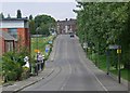
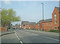

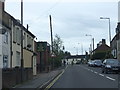
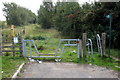
18 photos from this area
Area Information
Key information about the DE11 8EX including its size, population, and administrative classification.
- Area Type
- Postcode
- Area Size
- 14.6 hectares
- Population
- 1630
- Population Density
- 2261 people/km²
House Prices in DE11 8EX
27
Properties
£155,427
Average Sold Price
£95,000
Lowest Price
£300,000
Highest Price
Showing 27 properties
| Address | Type | Beds | Baths | Last Sale Price | Last Sale Date | |
|---|---|---|---|---|---|---|
| 17 Occupation Lane, Woodville, Swadlincote, DE11 8EX | Detached | 4 | 1 | £300,000 | Oct 2022 | |
| 21 Occupation Lane, Woodville, Swadlincote, DE11 8EX | Semi-detached | 3 | 3 | £178,000 | Jun 2021 | |
| 5 Occupation Lane, Woodville, Swadlincote, DE11 8EX | Terraced | 2 | 1 | £126,000 | Aug 2020 | |
| 1 Occupation Lane, Woodville, Swadlincote, DE11 8EX | house | - | - | £105,800 | Jul 2017 | |
| 15 Occupation Lane, Woodville, Swadlincote, DE11 8EX | Detached | 4 | 2 | £202,500 | Jul 2017 | |
| 3 Occupation Lane, Woodville, Swadlincote, DE11 8EX | Semi-detached | 2 | 1 | £108,500 | Oct 2016 | |
| 7 Occupation Lane, Woodville, Swadlincote, DE11 8EX | Semi-detached | 2 | 1 | £95,000 | Jul 2013 | |
| 11 Occupation Lane, Woodville, Swadlincote, DE11 8EX | house | 4 | - | £195,000 | May 2011 | |
| 9 Occupation Lane, Woodville, Swadlincote, DE11 8EX | house | - | - | £124,950 | Oct 2007 | |
| 9A Occupation Lane, Woodville, Swadlincote, DE11 8EX | Terraced | 2 | 1 | £124,950 | Oct 2007 |
Page 1 of 3
Energy Efficiency in DE11 8EX
Amenities
Schools
| Rank | School | Type | Entry gender | Ages |
|---|
Explore more schools in this area
Go to Schools tabDemographics
Household Size
One person
most common
Accommodation Type
Houses
most common
Tenure
51
majority
Ethnic Group
White
most common
Religion
N/A
most common
Household Composition
N/A
most common
Age
47
median
Adults (30-64 years)
most common
Household Deprivation
N/A
with no deprivation
NS-SEC
23
in Lower managerial occupations
Explore more demographic insights in this area
Go to Demographics tabPlanning
Planning Constraints
- Flood RiskPremium
- Ramsar Wetland SitesPremium
- Area of Outstanding Natural BeautyPremium
- Protected Nature ReservePremium
- Protected WoodlandPremium