Area Overview for DE11 7AL
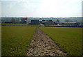
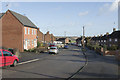
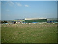
Photos of DE11 7AL

Area Information
Living in DE11 7AL means inhabiting a small, tightly knit residential cluster in South Derbyshire, England. The area spans just 1.2 hectares and is home to 1,529 people, creating a dense but manageable community. Its origins trace back to the Domesday Survey of 1086, when it was known as Heorteshorne, a name derived from the Anglo-Saxon for “hart’s horn.” Today, the area retains a historical character, with settlements dating to the Bronze Age and medieval periods. Daily life here is shaped by its compact size, with residents likely walking or cycling to local amenities. The mix of historic and modern infrastructure, including nearby retail and transport links, offers a blend of convenience and tradition. With a median age of 47, the community is predominantly composed of adults in their 30s to 60s, suggesting a stable, family-oriented environment. The area’s proximity to Burton and Willington railway stations, along with nearby schools, ensures access to essential services without the need for long commutes.
- Area Type
- Postcode
- Area Size
- 1.2 hectares
- Population
- 1529
- Population Density
- 906 people/km²
DE11 7AL is a predominantly owner-occupied area, with 75% of homes owned by residents rather than rented. The housing stock is composed entirely of houses, which is unusual for a small postcode area but suggests a focus on family homes and traditional living. This composition indicates a market where property is likely to be held long-term, with buyers seeking stability and space. The small size of the area means the housing stock is limited, which could drive demand from those prioritising proximity to local amenities such as schools and transport links. Given the high home ownership rate, rental opportunities are scarce, making the area more attractive to first-time buyers or those seeking a permanent residence. The absence of flats or apartments suggests a lack of high-density development, maintaining a low-rise, suburban character. For buyers, this means a focus on individual properties rather than shared spaces, with potential for long-term value retention.
House Prices in DE11 7AL
Showing 15 properties
| Address | Type | Beds | Baths | Last Sale Price | Last Sale Date | |
|---|---|---|---|---|---|---|
| 5 Field View, Woodville, Swadlincote, DE11 7AL | Detached | 4 | 2 | £280,000 | Mar 2025 | |
| 12 Field View, Woodville, Swadlincote, DE11 7AL | house | - | - | £165,000 | Mar 2023 | |
| 4 Field View, Woodville, Swadlincote, DE11 7AL | Terraced | 3 | 2 | £169,500 | May 2021 | |
| 2 Field View, Woodville, Swadlincote, DE11 7AL | Semi-detached | 3 | 2 | £157,000 | Oct 2020 | |
| 14 Field View, Woodville, Swadlincote, DE11 7AL | Terraced | 3 | 2 | £156,900 | Jun 2020 | |
| 9 Field View, Woodville, Swadlincote, DE11 7AL | Semi-detached | 3 | 2 | £176,500 | Aug 2019 | |
| 6 Field View, Woodville, Swadlincote, DE11 7AL | Terraced | 3 | 2 | £138,000 | Mar 2018 | |
| 3 Field View, Woodville, Swadlincote, DE11 7AL | Detached | 4 | 2 | £201,000 | Nov 2017 | |
| 11 Field View, Woodville, Swadlincote, DE11 7AL | Semi-detached | 3 | 1 | £165,000 | May 2017 | |
| 16 Field View, Woodville, Swadlincote, DE11 7AL | house | - | - | £160,000 | Nov 2016 |
Energy Efficiency in DE11 7AL
The lifestyle in DE11 7AL is shaped by its proximity to local amenities, including five retail outlets such as Asda Woodville Burton, Sainsburys Swadlincote, and Tesco Woodville. These stores provide essential shopping options, from groceries to household goods, reducing the need for long trips to larger centres. The area also has two railway stations — Burton and Willington — offering easy access to regional transport networks. While the data does not specify parks or leisure facilities, the historical context suggests a connection to natural landscapes, given the area’s origins in shallow valleys near Repton. The compact size of the area means residents can access daily necessities without excessive travel, fostering a convenient, self-contained lifestyle. The presence of multiple retail options and transport links enhances the area’s appeal, supporting both practical needs and a sense of community.
Amenities
Schools
Residents of DE11 7AL have access to a range of educational institutions, including Eureka Primary School, which holds an Ofsted rating of “good,” and Granville Academy, an academy with the same rating. Nearby is Granville Sports College, though its Ofsted rating is not specified. The presence of both primary and academy schools offers families a choice between traditional and alternative educational models. Eureka Primary’s “good” rating suggests a reliable foundation for early education, while Granville Academy’s status as an academy may indicate a focus on specialist or extended curriculum options. The proximity of these schools to the area ensures ease of access for families, reducing the need for long commutes. The mix of school types also implies a diverse educational landscape, catering to different pedagogical approaches and student needs. This variety is a key consideration for parents evaluating the area’s suitability for their children’s schooling.
| Rank | School | Type | Entry gender | Ages |
|---|
Explore more schools in this area
Go to Schools tabDemographics
The community in DE11 7AL is predominantly composed of adults aged 30–64, with a median age of 47. Home ownership is high at 75%, indicating a stable, long-term resident base. The area is primarily occupied by houses, reflecting a traditional, family-focused housing stock. The predominant ethnic group is White, though specific data on diversity is not provided. With a population density of 906 people per square kilometre, the area is neither overcrowded nor sparse, balancing residential comfort with community cohesion. The age profile suggests a mature demographic, likely with established careers and families. This stability is reinforced by the presence of local schools and amenities, which cater to the needs of working-age adults and their dependents. The high home ownership rate also implies lower rental activity, shaping the area as more of a settled, rather than transient, community.
Household Size
Accommodation Type
Tenure
Ethnic Group
Religion
Household Composition
Age
Household Deprivation
NS-SEC
Explore more demographic insights in this area
Go to Demographics tabPlanning
Planning Constraints
- Flood RiskPremium
- Ramsar Wetland SitesPremium
- Area of Outstanding Natural BeautyPremium
- Protected Nature ReservePremium
- Protected WoodlandPremium